
Valsot
Valsot | |
|---|---|
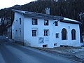
 Fountain in the village of Tschlin | |
 Flag  Coat of arms | |
Location of Valsot  | |
Chaflur) and Tschlin | |
| Surrounded by | Graun im Vinschgau (IT-BZ), Nauders (AT-7), Pfunds (AT-7), Samnaun, Spiss (AT-7) |
| Website | https://www.valsot.ch SFSO statistics |
Valsot is a
History
Ramosch
In 1956–58, on the hill Mottata (ca. 1.5 kilometers (0.93 mi) north-east of Ramosch), a significant prehistoric site was discovered. The Mottata site contains three settlement horizons, two from the mid and early
Tschlin

While
Geography


Valsot has an area of 158.96 km2 (61.37 sq mi).
Ramosch had an area, as of 2006[update], of 84.1 km2 (32.5 sq mi). Of this area, 32.7% is used for agricultural purposes, while 26.5% is forested. Of the rest of the land, 0.7% is settled (buildings or roads) and the remainder (40.1%) is non-productive (rivers, glaciers or mountains).[6] It is along the left bank of the Inn river. It consists of the village of Ramosch and the village section of Vnà as well as the settlements of Raschvella and Seraplana. Until 1943 Ramosch was known as Remüs.[3]
Tschlin had an area, as of 2006[update], of 75.1 km2 (29.0 sq mi). Of this area, 28.7% is used for agricultural purposes, while 34.7% is forested. Of the rest of the land, 1.3% is settled (buildings or roads) and the remainder (35.3%) is non-productive (rivers, glaciers or mountains).[6] It consists of the village of Tschlin on a terrace above the left bank of the Inn, the sections of Strada and Martina and the hamlets of San Niclà, Chaflur, Sclamischot and Vinadi. Until 1943 Tschlin was known as Schleins.[3]
Demographics
Valsot has a combined population (as of 31 December 2020) of 826.[7]
Historic population
The historical population is given in the following chart:[8]

Languages
Most of the population in Ramosch (as of 2000[update]) speaks Romansh (84.1%), with German being second most common (13.9%) and Dutch being third (1.1%).[6]
Ramosch
| Languages in Ramosch | ||||||
| Languages | Census 1980 | Census 1990 | Census 2000 | |||
| Number | Percent | Number | Percent | Number | Percent | |
| German | 44 | 9.69% | 59 | 13.35% | 61 | 13.86% |
| Romansh | 399 | 87.89% | 363 | 82.13% | 370 | 84.09% |
| Italian | 9 | 1.98% | 15 | 3.39% | 2 | 0.45% |
| Population | 454 | 100% | 442 | 100% | 440 | 100% |
Tschlin
Most of the population of Tschlin (as of 2000[update]) speaks Romansh (71.4%), with German being second most common (25.5%) and italian being third (1.0%).[6]
| Languages in Tschlin | ||||||
| Languages | Census 1980 | Census 1990 | Census 2000 | |||
| Number | Percent | Number | Percent | Number | Percent | |
| German | 64 | 14.85% | 130 | 25.24% | 100 | 25.51% |
| Romansh | 362 | 83.99% | 313 | 60.78% | 280 | 71.43% |
| Italian | 4 | 0.93% | 33 | 6.41% | 3 | 0.77% |
| Population | 431 | 100% | 515 | 100% | 392 | 100% |
Heritage sites of national significance
-
 Castle Tschanüff
 -
 St. Florinus, looking down the nave
 -
 St. Florinus, looking toward the sanctuary
 -
 Museum Stamparia Da Strada


References
- ^ a b "Arealstatistik Standard - Gemeinden nach 4 Hauptbereichen". Federal Statistical Office. Retrieved 13 January 2019.
- ^ "Ständige Wohnbevölkerung nach Staatsangehörigkeitskategorie Geschlecht und Gemeinde; Provisorische Jahresergebnisse; 2018". Federal Statistical Office. 9 April 2019. Retrieved 11 April 2019.
- ^ a b c Amtliches Gemeindeverzeichnis der Schweiz published by the Swiss Federal Statistical Office (in German) accessed 2 January 2013
- ^ Ramosch in German, French and Italian in the online Historical Dictionary of Switzerland.
- ^ Tschlin in German, French and Italian in the online Historical Dictionary of Switzerland.
- ^ a b c d Swiss Federal Statistical Office accessed 12-Oct-2009
- ^ "Ständige und nichtständige Wohnbevölkerung nach institutionellen Gliederungen, Geburtsort und Staatsangehörigkeit". bfs.admin.ch (in German). Swiss Federal Statistical Office - STAT-TAB. 31 December 2020. Retrieved 21 September 2021.
- ^ Federal Statistical Office STAT-TAB Bevölkerungsentwicklung nach Region, 1850–2000 Archived 2012-03-17 at the Wayback Machine (in German) accessed 29 January 2011
- ^ Swiss inventory of cultural property of national and regional significance Archived 2009-05-01 at the Wayback Machine 21.11.2008 version, (in German) accessed 12-Oct-2009
| ||
| International | |
|---|---|
| National | |
| Other | |