
Vineyard Haven, Massachusetts
Vineyard Haven, Massachusetts | ||
|---|---|---|
FIPS code 25-71970 | | |
| GNIS feature ID | 0616143 | |
.jpg)
Vineyard Haven is a community within the town of
The area was called "Nobnocket" by the
Vineyard Haven is the main port of entry to Martha's Vineyard and one of the three main population centers (with Edgartown and Oak Bluffs). The Steamship Authority wharf is located in Vineyard Haven where ferries arrive and depart year-round. (A second, seasonal wharf is located in neighboring Oak Bluffs.) The year-round population is only about 2,000 people, but that number increases tremendously in the summer.
Geography
Vineyard Haven is located at 41°27′22″N 70°36′26″W / 41.456109°N 70.607176°W.[4]
According to the United States Census Bureau, the CDP has a total area of 4.1 km2 (1.6 mi2). 3.2 km2 (1.2 mi2) of it is land and 0.9 km2 (0.3 mi2) of it (20.89%) is water.
Demographics
| Census | Pop. | Note | %± |
|---|---|---|---|
| 2020 | 2,747 | — | |
| U.S. Decennial Census[5] | |||
As of the
There were 941 households, out of which 23.1% had children under the age of 18 living with them, 37.2% were married couples living together, 10.4% had a female householder with no husband present, and 49.0% were non-families. 39.1% of all households were made up of individuals, and 14.3% had someone living alone who was 65 years of age or older. The average household size was 2.17 and the average family size was 2.93.
In the CDP, the population was spread out, with 20.6% under the age of 18, 6.3% from 18 to 24, 30.8% from 25 to 44, 25.7% from 45 to 64, and 16.7% who were 65 years of age or older. The median age was 41 years. For every 100 females, there were 92.3 males. For every 100 females age 18 and over, there were 86.9 males.
The median income for a household in the CDP was $37,318, and the median income for a family was $44,844. Males had a median income of $35,824 versus $28,750 for females. The
Transportation
Air Service is provided from Martha's Vineyard Airport.
The most reliable source of public transportation from Vineyard Haven to the rest of the island is the Martha's Vineyard Regional Transit Authority (VTA). Almost all of the buses stop at the Vineyard Haven
References
- ^ "2020 U.S. Gazetteer Files". United States Census Bureau. Retrieved May 21, 2022.
- ^ "Geographic Identifiers: 2010 Demographic Profile Data (G001): Vineyard Haven CDP, Massachusetts". U.S. Census Bureau, American Factfinder. Archived from the original on February 13, 2020. Retrieved October 30, 2015.
- ^ Banks, Charles E. The History of Martha's Vineyard, Vol. II (Dukes County Historical Society)
- ^ "US Gazetteer files: 2010, 2000, and 1990". United States Census Bureau. February 12, 2011. Retrieved April 23, 2011.
- ^ "Census of Population and Housing". Census.gov. Retrieved June 4, 2016.
- ^ "U.S. Census website". United States Census Bureau. Retrieved January 31, 2008.
- ^ "Vineyard Transit Authority |".
Municipalities and communities of Dukes County, Massachusetts, United States | ||
|---|---|---|
| Towns | 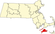 | |
| CDPs | ||
| Other villages | ||
| Indian reservation | ||
| ||
| International | |
|---|---|
| National | |