
Vyškov Gate
| Vyškov Gate | |
|---|---|
.JPG) Vyškov Gate – view to south from Nemojany | |
| Highest point | |
| Peak | Na hanácké |
| Elevation | 339 m (1,112 ft) |
| Dimensions | |
| Length | 17 km (11 mi) |
| Naming | |
| Native name | Vyškovská brána (Czech) |
| Geography | |
 Vyškov Gate Vyškovská brána CZ III1 A-2.png | |
| Country | Carpathians |
The Vyškov Gate (
Danube basin runs through it and Rakovec brook (in the Dyje–Svratka Valley). The gate is between the Upper Morava Valley (in the north-east) and the Dyje–Svratka Valley (in the south-west), all in Outer Subcarpathian
depression.
Including low watershed (drainage divide) Na hanácké – 339 m
The Vyškov Gate has been a natural pass between the
also traversed the Vyškov Gate.Gallery
-
 Haná River in Vyškov Gate
 -
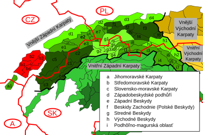 Moravian Carpathians (marked in red) within the Outer Western Carpathian


See also
References
- ^ "About the Carpathians – Carpathian Heritage Society". Archived from the original on 6 April 2010. Retrieved 28 April 2010.
| Authority control databases: National |
|---|