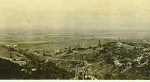
Well, Hill 4
Appearance
| Well, Hill 4 | |
|---|---|
 Lompoc Oil Field map site of Well, Hill 4 | |
| Location | Unocal Corporation, Lompoc, Santa Barbara County, California |
| Coordinates | 34°42′58″N 120°24′33″W / 34.716075°N 120.409202777778°W |
| Official name | Well, Hill 4 |
| Designated | May 1, 1957 |
| Reference no. | 582 |


The Well, Hill 4 is a
oil deposit. The oil well did not run dry till 1951.[1] The well is named after engineer Frank E. Hill who was the leader of the first successful pumping cement cap. [2]
The California State Historical Landmark reads:
- NO. 582 WELL, HILL 4 - This well, spudded September 26, 1905, and completed April 30, 1906, is the first oil well in which a water shutoff was attained by pumping cement through the tubing and back of the casing-forerunner of the modern cementing technique. It was drilled to a depth of 2,507 feet by Union Oil Company of California, 1,872 feet of 10-inch casing and 2,237 feet of 8-inch casing were so securely cemented off that the well produced for over forty-five years. [3]
See also
- History of Santa Barbara, California
- California Historical Landmarks in Santa Barbara County, California
- California oil and gas industry
References
- ^ ohp.parks.ca.gov, Well, Hill 4
- ^ Union Oil Project/Exxon Project Shamrock and Central Santa Maria Basin Area Area Study, March 18, 1985, Tech App. G, page 76
- ^ californiahistoricallandmarks.com # 582
