
Xiangshan, Taipei
| Xiangshan | |
|---|---|
| Elephant Mountain | |
 Xiangshan as viewed from Taipei 101's observation deck | |
| Highest point | |
| Elevation | 183 metres (600 ft) |
| Coordinates | 25°01′37″N 121°34′36″E / 25.0269°N 121.5766°E |
| Geography | |
 Xiangshan The location of Xiangshan | |
| Location | Xinyi District, Taipei, Taiwan |
| Climbing | |
| Easiest route | Hiking trail |
Xiangshan (
Name
"Xiangshan" means "Elephant Mountain" in Chinese. Xiangshan's name comes from its elephant-like shape.[3]
Geology

330yds
Xiangshan is one of the Four Beast Mountains (四獸山),
Transportation
The trail to the mountain summit and observation platforms is accessible by walking south from Exit 2 of Xiangshan Station of the Taipei Metro, proceeding along Xiangshan Park to the western trailhead next to Daitiandian Lingyun Temple.[5]
As an alternative, hikers may proceed from the eastern end, starting from the trailhead behind Songshan Fengtian Temple, which is a short walk south from the Houshanpi station.[1]
-
View of the Taipei Basin from the Six Giant Rocks, 2013
-
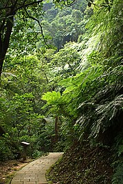 Xiangshan hiking trail
 -
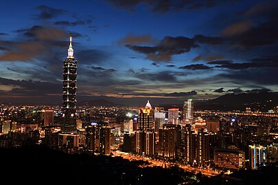 Taipei skyline viewed from Xiangshan, including Taipei 101, illuminated at dusk (2015)
 -
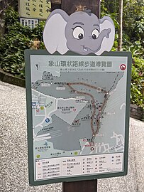 Trail map
 -
 Western trailhead near Daitiandian Lingyun Temple with steep, narrow stairways
 -
 Summit marker
 -
 Observation deck
 -
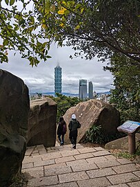 Hikers descending through cut in massive boulders
 -
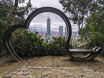 Taipei 101, framed in elephant-shaped bench at summit


_20240114_02.jpg)


- Panoramic views from Xiangshan
-
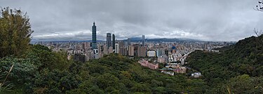 Panorama (day)
 -
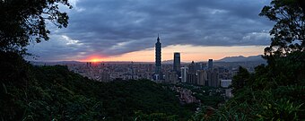 Panorama (sunset)
 -
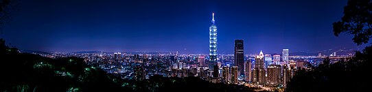 Panorama (night)


References
- ^ a b c d Saunders, Richard (February 2, 2018). "Off the Beaten Track: On the Trail of the Four Beasts". Taipei Times. Retrieved 2018-03-03.
- ^ a b c "Nangang Mountain System: Xiangshan (Mt. Elephant) Hiking Trail". Travel.Taipei. Department of Information and Tourism, Taipei City Government. 2016-04-14. Retrieved 2016-04-23.
- ^ a b "Mt. Elephant Trail (Xiangshan)". Hikingbook Inc. Retrieved 2024-02-22.
- ^ Liao, George (December 28, 2017). "Xiangshan good for watching Taipei 101 fireworks display but not for light show: GEO". Taiwan News. Retrieved 2018-03-03.
- ^ "Elephant Mountain (Taipei) - The adventurer's guide to conquering Xiangshan". Big Little Island. 18 September 2019. Retrieved August 13, 2022.
This Asia mountain, mountain range, or peak related article is a stub. You can help Wikipedia by expanding it. |
This article about a location in Taiwan is a stub. You can help Wikipedia by expanding it. |