
Yale, Oklahoma
Yale, Oklahoma | ||
|---|---|---|
FIPS code 40-82500[3] | | |
| GNIS feature ID | 2412315[2] | |
Yale is a city in
History

Yale's founding in 1895 is attributed to a local farmer, Sterling F. Underwood, who established a post office by that name in his general store, about 1.5 miles (2.4 km) east of the present town. When the Eastern Oklahoma Railway built its line across Payne County, a group led by George W. Canfield began a different townsite also within Eagle Township that would be closer to the railroad, at its planned junction with the Missouri–Kansas–Texas Railroad. Underwood moved his store to the new site in 1902, making the new site the permanent location for the town of Yale. A 1907 map shows the town contained 230 acres surrounding the railroad junction, and to its east southeast the Underwood farm of 158 acres.[5] By 1910, Yale had a population of 685, supported mostly by agricultural services and cotton processing.[6]
On September 23, 1913, an oil well on the Randle farm produced a gusher. An even larger gusher began producing a month later. More discoveries followed. By the end of 1914, the combined Yale and Cushing fields were producing 220,000 barrels a day. The town boomed, attaining a population of 2,601 by the census of 1920.[6]
The oil boom quickly deflated. Production began to decline sharply in 1915, and more dry holes were reported. Major producers began to shut down or reduce operations in the early 1920s. By 1930, the population had dropped to 1,734. In 1940, the census reported a population of 1,407. The decline continued until reaching a low of 1,239 in 1970. There was a spike by 1980, when the census recorded 1,652, but the downward trend resumed through 2010. Town officials have tried to stem the decline by promoting Yale as a retirement location.[6]
Geography
Yale is 20 miles (32 km) east of Stillwater on State Highway 51.[6] According to the United States Census Bureau, the city has a total area of 0.9 square miles (2.3 km2), all land.
The primary source of Yale's water supply is Lone Chimney Lake. The lake's level has been declining for several years because of prolonged drought conditions and high water consumption of water by Yale and other Oklahoma towns that rely on this lake as their primary source.[7]
Demographics
| Census | Pop. | Note | %± |
|---|---|---|---|
| 1910 | 685 | — | |
| 1920 | 2,601 | 279.7% | |
| 1930 | 1,734 | −33.3% | |
| 1940 | 1,407 | −18.9% | |
| 1950 | 1,359 | −3.4% | |
| 1960 | 1,369 | 0.7% | |
| 1970 | 1,239 | −9.5% | |
| 1980 | 1,652 | 33.3% | |
| 1990 | 1,392 | −15.7% | |
| 2000 | 1,342 | −3.6% | |
| 2010 | 1,227 | −8.6% | |
| 2020 | 1,059 | −13.7% | |
| U.S. Decennial Census[8] | |||
As of the
There were 529 households, out of which 32.1% had children under the age of 18 living with them, 51.0% were married couples living together, 10.6% had a female householder with no husband present, and 32.1% were non-families. 30.2% of all households were made up of individuals, and 14.6% had someone living alone who was 65 years of age or older. The average household size was 2.47 and the average family size was 3.04.
In the city, the population was spread out, with 26.7% under the age of 18, 10.3% from 18 to 24, 25.6% from 25 to 44, 20.0% from 45 to 64, and 17.5% who were 65 years of age or older. The median age was 36 years. For every 100 females, there were 91.2 males. For every 100 females age 18 and over, there were 88.1 males.
The median income for a household in the city was $23,403, and the median income for a family was $30,714. Males had a median income of $26,630 versus $15,813 for females. The
Government
Yale had a city manager form of government.[6]
Notable people
- Chet Baker jazz trumpeter and vocalist, born in Yale in 1929.
- Jim Thorpe Olympic gold medalist, lived in Yale from 1917 to 1923.
References
- ^ "ArcGIS REST Services Directory". United States Census Bureau. Retrieved September 20, 2022.
- ^ a b U.S. Geological Survey Geographic Names Information System: Yale, Oklahoma
- ^ "U.S. Census website". United States Census Bureau. Retrieved January 31, 2008.
- ^ CensusViewer:Population of the City of Yale, Oklahoma. Accessed March 29, 2012
- ^ 1907 Map of Eagle Township, Payne County, Oklahoma, accessed December 2017 (via ancestry.com paid subscription site).
- ^ a b c d e D. Earl Newsom, "Yale," Encyclopedia of Oklahoma History and Culture. Accessed March 30, 2012.
- ^ "Yale struggles with water shortage." The Journal Record (archive). March 25, 2013. Accessed September 6, 2015.
- ^ "Census of Population and Housing". Census.gov. Retrieved June 4, 2015.
- ^ a b "2010 City Population and Housing Occupancy Status". U.S. Census Bureau. Retrieved October 18, 2013.[dead link]
External links
Municipalities and communities of Payne County, Oklahoma, United States | ||
|---|---|---|
| Cities | 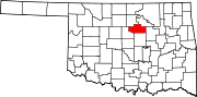 | |
| Towns | ||
| CDPs | ||
| Other communities | ||
| Ghost town | ||
| Footnotes | ‡This populated place also has portions in an adjacent county or counties | |
| ||
| International | |
|---|---|
| National | |
| Geographic | |