
Zahara de la Sierra
Zahara de la Sierra | |
|---|---|
.jpg) | |
|
UTC+2 (CEST) | |
| Website | Official website |
Zahara de la Sierra is a municipality in the
pueblos blancos
or "white towns" because the overwhelming majority of the buildings are white.
The town was originally a Moorish outpost, overlooking the valley. Due to its position between Ronda and Seville, it was a perfect site for a castle to be built to serve as a fortress in case of attack. The remains of the Moorish castle still exist. It was ruled by Arabs until 1407. It was recaptured by the Emirate of Granada in 1481. This capture gave a pretext to Castile's war against Granada. It was finally captured by Castilian troops under command of Rodrigo Ponce de León, Duke of Cádiz in 1483.
The Garganta Verde canyon is located nearby.
-
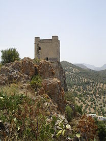 The castle
 -
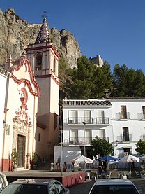 View in the town


References
- ^ Municipal Register of Spain 2018. National Statistics Institute.
External links
Wikimedia Commons has media related to Zahara de la Sierra.
| International | |
|---|---|
| National | |
This article about a location in Andalusia, Spain, is a stub. You can help Wikipedia by expanding it. |