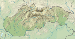
Zlaté Piesky
| Zlaté piesky | |
|---|---|
 Zlaté piesky in June 2007 | |
| Coordinates | 48°11′05″N 17°11′22″E / 48.18472°N 17.18944°E |
| Basin countries | Slovakia |
| Settlements | Bratislava |

Zlaté Piesky (literally Golden Sands) is a
D1
motorway.
Characteristics
The water area stretches 400 metres, with the depth reaching 30 metres. The lake and surrounding area comprise the largest recreational and sporting region in Bratislava. On its northern shore, there are a major tent camp called Intercamp and several restaurants; a shopping centre is within walking distance.
Visitors can take part in different sports at the resort, such as swimming,
mini-golf, tennis
and others.
The 1976 tragedy
On 28 July 1976, Zlaté Piesky witnessed one of the most tragic
airport
and crashed into the lake. Seventy passengers and six crew members died.
Aerial photos and maps
- 48°11′05″N 17°11′22″E / 48.18472°N 17.18944°E
- Google (2012-02-04). "satellite view of Zlaté piesky" (Map). Google Maps. Google. Retrieved 2012-02-04.
External links
- One day at Zlaté Piesky—a photo album (in Czech)

