
Clermont County, Ohio
Clermont County | |
|---|---|
 Clermont Commission Building, Batavia | |
|
UTC−4 (EDT) | |
| Congressional district | 2nd |
| Website | http://www.clermontcountyohio.gov/ |
Clermont County, popularly called Clermont (/ˈklɛərmɒnt/ CLARE-mont),[2][3][4][5][6][7] is a county in the U.S. state of Ohio. As of the 2020 census, the population was 208,601.[8] Ordinanced in 1800 as part of the Virginia Military District, Clermont is Ohio's eighth oldest county, the furthest county west in Appalachian Ohio, and the eleventh oldest county of the former Northwest Territory.[9] Clermont County is part of the Cincinnati, OH-KY-IN Metropolitan Statistical Area. The county is
Its county seat is Batavia, while its largest city is Milford.History
Clermont's name is borrowed from a
At its ordinance in 1800 by the
During the 1800s,
Also in 1844, America's first anarchist, philosopher, and inventor
-
-
 Governor
 -
 Chief Justice


.jpg)
Clermont's last-standing covered bridge was built in 1878 on Stonelick Williams Corner Road, near US Route 50; it was renovated in 2014.[16] The Grant birthplace, originally a one-room cabin, continues to welcome visitors and in 1890 was removed from its original location, travelling by boat to be viewed by citizens along various waterways. It was also taken to the 1893 Chicago World's Fair before returning to Clermont.
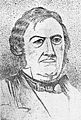
Pattison became the first Clermont Countian elected Governor of Ohio in 1905, Ohio's first
Geography
According to the United States Census Bureau, the county has a total area of 460 square miles (1,200 km2), of which 452 square miles (1,170 km2) is land and 7.7 square miles (20 km2) (1.7%) is water.[18]
Adjacent counties
- Brown County (east)
- Bracken County, Kentucky (south)
- Pendleton County, Kentucky (southwest)
- Campbell County, Kentucky (southwest)
- Hamilton County (west)
- Warren County (north)
- Clinton County (north east)
Demographics
| Census | Pop. | Note | %± |
|---|---|---|---|
| 1810 | 9,965 | — | |
| 1820 | 15,820 | 58.8% | |
| 1830 | 20,466 | 29.4% | |
| 1840 | 23,106 | 12.9% | |
| 1850 | 30,455 | 31.8% | |
| 1860 | 33,034 | 8.5% | |
| 1870 | 34,268 | 3.7% | |
| 1880 | 36,713 | 7.1% | |
| 1890 | 33,553 | −8.6% | |
| 1900 | 31,610 | −5.8% | |
| 1910 | 29,551 | −6.5% | |
| 1920 | 28,291 | −4.3% | |
| 1930 | 29,786 | 5.3% | |
| 1940 | 34,109 | 14.5% | |
| 1950 | 42,182 | 23.7% | |
| 1960 | 80,530 | 90.9% | |
| 1970 | 95,725 | 18.9% | |
| 1980 | 128,483 | 34.2% | |
| 1990 | 150,187 | 16.9% | |
| 2000 | 177,977 | 18.5% | |
| 2010 | 197,363 | 10.9% | |
| 2020 | 208,601 | 5.7% | |
| 2022 (est.) | 210,805 | [19] | 1.1% |
| U.S. Decennial Census[20] 1790–1960[21] 1900–1990[22] 1990–2000[23] 2010-2020[8] | |||
2010 census
As of the census of 2010, there were 197,363 people, 74,828 households, and 53,800 families residing in the county.[24] The population density was 436.5 inhabitants per square mile (168.5/km2). There were 80,656 housing units at an average density of 178.4 per square mile (68.9/km2).[25] The racial makeup of the county was 95.9% white, 1.2% black or African American, 1.0% Asian, 0.2% American Indian, 0.4% from other races, and 1.3% from two or more races. Those of Hispanic or Latino origin made up 1.5% of the population.[24] In terms of ancestry, 34.0% were German, 18.1% were Irish, 12.0% were American, and 11.1% were English.[26]
Of the 74,828 households, 35.9% had children under the age of 18 living with them, 56.1% were married couples living together, 10.9% had a female householder with no husband present, 28.1% were non-families, and 22.5% of all households were made up of individuals. The average household size was 2.61 and the average family size was 3.06. The median age was 38.5 years.[24]
The median income for a household in the county was $58,472 and the median income for a family was $68,485. Males had a median income of $50,204 versus $36,746 for females. The per capita income for the county was $27,900. About 6.9% of families and 9.3% of the population were below the poverty line, including 12.6% of those under age 18 and 5.5% of those age 65 or over.[27]
2000 census
As of the
ancestry.There were 66,013 households, out of which 38.10% had children under the age of 18 living with them, 60.40% were married couples living together, 10.00% had a female householder with no husband present, and 25.70% were non-families. 21.00% of all households were made up of individuals, and 7.00% had someone living alone who was 65 years of age or older. The average household size was 2.67 and the average family size was 3.11.
In the county the population was spread out, with 27.90% under the age of 18, 8.40% from 18 to 24, 31.70% from 25 to 44, 22.60% from 45 to 64, and 9.40% who were 65 years of age or older. The median age was 35 years. For every 100 females there were 96.40 males. For every 100 females age 18 and over, there were 93.60 males.
The median income for a household in the county was $49,386, and the median income for a family was $57,032. Males had a median income of $40,739 versus $27,613 for females. The per capita income for the county was $22,370. About 5.30% of families and 7.10% of the population were below the poverty line, including 8.70% of those under age 18 and 7.90% of those age 65 or over.
Economy
Aviation is served by the Clermont County Airport. Clermont's newspapers are the Clermont Sun, positing historical stories and statistics, and the Community Press papers. According to the county's 2021 Annual Comprehensive Financial Report,[28] the top employers in the county are:
| # | Employer | # of Employees | Location |
|---|---|---|---|
| 1 | Total Quality Logistics | 2,000 | Union Township |
| 2 | American Modern Insurance Group
|
1,207 | Batavia Township |
| 3 | Clermont County | 1,152 | Batavia |
| 4 | Mercy Hospital - Clermont Hospital | 850 | Batavia Township |
| 5 | West Clermont Local School District | 835 | Union Township |
| 6 | Milford Exempted Village School District | 767 | Miami Township |
| 7 | Siemens Digital Industries Software | 750 | Miami Township |
| 8 | Milacron | 662 | Williamsburg Township |
| 9 | L3 Harris Fuzing & Ordnance Systems
|
607 | Withamsville |
| 10 | Huhtamaki, Inc. | 500 | Batavia Township |
Education
Colleges and high schools in Clermont
These buildings may not have been high schools when they were first constructed, but have since become high schools. The building years listed connote the current buildings' initial openings and do not include renovations or additions.[citation needed]
- (1957) Clermont Northeastern High School, 5327 Hutchinson Road, Batavia
- (1963) Milford High School, One Eagles Way, Milford
- (1965) New Richmond High School, 1131 Bethel-New Richmond Road, New Richmond
- (1972) Clermont College, 4200 Clermont College Drive, Batavia
- (1996) Williamsburg High School, 500 South Fifth Street, Williamsburg
- (1997) Batavia High School, One Bulldog Place, Batavia
- (2002) Bethel-Tate High School, 3420 Ohio Rt. 125, Bethel
- (2002) Goshen High School, 6707 Goshen Road, Goshen
- (2004) Felicity-Franklin High School, 105 Market Street, Felicity
- (2017) West Clermont High School, 4101 Bach Buxton Rd, Cincinnati,
Parks and libraries
Clermont County has the
Politics
All of Clermont's elected officeholders, including judges, are members of the Republican Party.[citation needed]
U.S. House of Representatives
Clermont's congressional seat is occupied by Brad Wenstrup, who resides in Cincinnati, Hamilton County, Ohio.
Elected Commission
The three seats of the Clermont Commission are occupied by Edwin Humphrey, last elected 2016; David Painter, last elected 2016; and Claire B. Corcoran. The commission employs an administrator, Thomas Eigel (as of 2020), to run day-to-day operations of Clermont.
Ohio Statehouse
Encompassing all of Clermont, the 14th Ohio Senate seat is occupied by Terry Johnson, last elected 2020. Covering northern Clermont, the 65th statehouse seat is occupied by Jean Schmidt, last elected 2020. Covering southern Clermont, the 66th statehouse seat is occupied by Adam Bird, last elected 2020.
Elected Officers
Clermont's elected officers include Debbie Clepper, Recorder; Mark J. Tekulve, Prosecutor; Linda Fraley, Auditor; Robert S. Leahy, Sheriff; Jeremy Evans, Engineer; Paul Kamphaus, Municipal Clerk of Courts; Brian Treon, Coroner; Jeannie Zurmehly, Treasurer; and Barbara Wiedenbein, Common Pleas Clerk of Courts.
Elected Judges
The elected Common Pleas Court is occupied by Judge Richard Ferenc, Judge Victor Haddad, Judge Anthony W. Brock, and Judge Kevin Miles. The elected Common Pleas Domestic Relations Court is occupied by Judge Mary Lynne Birck. The elected Municipal Court is occupied by Judge Jesse Kramig, Judge Jason E. Nagel, and Judge Anita M. Bechmann. The elected Probate/Juvenile Court is occupied by Judge James A. Shriver.
National outcomes
Prior to 1912, Clermont County voted for Democratic candidates in presidential elections, only voting Republican three times between 1856 and 1912. The county was a bellwether from 1912 to 1936. Starting with the 1940 election, it has become more Republican-leaning, with Lyndon B. Johnson being the lone Democrat to win since. Clermont has been visited by recent national ticket candidates from Republicans and Democrats.[32][33][34][35][36]
| Year | Republican | Democratic | Third party | |||
|---|---|---|---|---|---|---|
| No. | % | No. | % | No. | % | |
| 2020 | 74,570 | 67.36% | 34,092 | 30.79% | 2,048 | 1.85% |
| 2016 | 67,518 | 67.54% | 26,715 | 26.72% | 5,739 | 5.74% |
| 2012 | 64,208 | 66.52% | 30,458 | 31.55% | 1,859 | 1.93% |
| 2008 | 62,559 | 65.35% | 31,611 | 33.02% | 1,564 | 1.63% |
| 2004 | 62,949 | 70.67% | 25,887 | 29.06% | 243 | 0.27% |
| 2000 | 47,129 | 67.45% | 20,927 | 29.95% | 1,821 | 2.61% |
| 1996 | 36,457 | 56.81% | 21,329 | 33.24% | 6,388 | 9.95% |
| 1992 | 32,065 | 49.99% | 17,558 | 27.37% | 14,519 | 22.64% |
| 1988 | 37,417 | 70.49% | 15,352 | 28.92% | 316 | 0.60% |
| 1984 | 35,316 | 74.63% | 11,713 | 24.75% | 290 | 0.61% |
| 1980 | 26,674 | 63.37% | 13,199 | 31.36% | 2,218 | 5.27% |
| 1976 | 19,616 | 55.99% | 14,850 | 42.38% | 571 | 1.63% |
| 1972 | 22,936 | 71.70% | 8,276 | 25.87% | 777 | 2.43% |
| 1968 | 15,299 | 48.04% | 8,859 | 27.82% | 7,691 | 24.15% |
| 1964 | 13,367 | 44.72% | 16,523 | 55.28% | 0 | 0.00% |
| 1960 | 18,802 | 61.60% | 11,723 | 38.40% | 0 | 0.00% |
| 1956 | 14,914 | 62.30% | 9,026 | 37.70% | 0 | 0.00% |
| 1952 | 13,221 | 57.68% | 9,702 | 42.32% | 0 | 0.00% |
| 1948 | 8,592 | 50.88% | 8,224 | 48.70% | 71 | 0.42% |
| 1944 | 9,125 | 53.48% | 7,937 | 46.52% | 0 | 0.00% |
| 1940 | 9,367 | 51.16% | 8,942 | 48.84% | 0 | 0.00% |
| 1936 | 7,608 | 44.05% | 9,204 | 53.29% | 458 | 2.65% |
| 1932 | 7,684 | 46.10% | 8,662 | 51.97% | 321 | 1.93% |
| 1928 | 9,732 | 69.60% | 4,194 | 29.99% | 57 | 0.41% |
| 1924 | 6,867 | 55.18% | 4,544 | 36.51% | 1,034 | 8.31% |
| 1920 | 6,857 | 51.91% | 6,245 | 47.27% | 108 | 0.82% |
| 1916 | 3,549 | 44.76% | 4,247 | 53.56% | 133 | 1.68% |
| 1912 | 2,543 | 33.47% | 3,610 | 47.52% | 1,444 | 19.01% |
| 1908 | 4,137 | 48.91% | 4,150 | 49.07% | 171 | 2.02% |
| 1904 | 4,207 | 53.77% | 3,339 | 42.68% | 278 | 3.55% |
| 1900 | 3,990 | 47.43% | 4,244 | 50.45% | 178 | 2.12% |
| 1896 | 4,272 | 47.36% | 4,672 | 51.80% | 76 | 0.84% |
| 1892 | 3,715 | 45.92% | 4,069 | 50.29% | 307 | 3.79% |
| 1888 | 4,097 | 48.17% | 4,180 | 49.15% | 228 | 2.68% |
| 1884 | 4,242 | 49.26% | 4,193 | 48.69% | 177 | 2.06% |
| 1880 | 4,028 | 46.31% | 4,417 | 50.79% | 252 | 2.90% |
| 1876 | 3,848 | 47.06% | 4,315 | 52.77% | 14 | 0.17% |
| 1872 | 3,408 | 48.20% | 3,658 | 51.73% | 5 | 0.07% |
| 1868 | 3,475 | 49.16% | 3,594 | 50.84% | 0 | 0.00% |
| 1864 | 3,316 | 50.02% | 3,314 | 49.98% | 0 | 0.00% |
| 1860 | 2,965 | 46.06% | 3,206 | 49.81% | 266 | 4.13% |
| 1856 | 2,188 | 38.32% | 2,741 | 48.00% | 781 | 13.68% |
Communities
Ohio recognizes municipalities (villages and cities) and townships.

Each municipality has an elected-nonpartisan
In 1991, the
Cities
Villages
- Batavia (county seat)
- Bethel
- Chilo
- Felicity
- Moscow
- Neville
- New Richmond
- Owensville
- Williamsburg
Dissolved villages
Townships
Census-designated places
Unincorporated communities
- Afton
- Amelia
- Bantam
- Belfast
- Blairsville
- Blowville
- Branch Hill
- Braziers
- Cedron
- Clermontville
- Clover
- Concord
- Edenton
- Elk Lick
- Glen Este
- Grailville
- Hamlet
- Hennings Mill
- Hills
- Laurel
- Lerado
- Lindale
- Locust Corner
- Maple
- Marathon
- Milford Hills
- Modest
- Monterey
- Moores Fork
- Mount Holly
- Mount Olive
- Mount Pisgah
- New Palestine
- Ninemile
- Nineveh
- Nicholsville
- Olive Branch
- Perintown
- Point Isabel
- Point Pleasant
- Pringle Corner
- Round Bottom
- Rural
- Saltair
- Simpkinsville
- Shiloh
- Springvale
- Stonelick
- Tobasco
- Utopia
- Wards Corner
- Wiggonsville
- Williams Corner
- Willowville
- Woodville
Gallery
-
 Amelia Bowdoin's House in Amelia
 -
 Goshen at Ohio Rt. 132
 -
 U.S. Grant's Birthplace at Point Pleasant
 -
 Miami Township Civic Center on Meijer Drive
 -
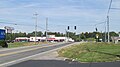
 Main Owensville intersection at US Rt. 50 and Ohio Rt. 132
 -
 The Promont in Milford
 -
 Stonelick-Williams Corner Covered Bridge near Owensville
 -
 Utopia marker on US Rt. 52
 -
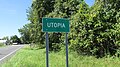 Utopia sign
 -
 Utopia, west on US Rt. 52
 -
 West Clermont High School aerial view


.JPG)


.JPG)
.JPG)


See also
References
- ^ "Ohio County Profiles: Clermont County" (PDF). Ohio Department of Development. Archived from the original (PDF) on June 21, 2007. Retrieved April 28, 2007.
- ^ "Clermont Chorale". Clermont Chorale. 2017. Retrieved February 23, 2017.
- ^ "Clermont Chamber". Clermont Chamber of ommerce. 2017. Retrieved February 23, 2017.
- ^ "West Clermont Local School District". West Clermont School District. 2017. Retrieved February 23, 2017.
- ^ "Clermont Northeastern Schools". Clermont Northeastern Schools. 2017. Retrieved February 23, 2017.
- ^ "Clermont College". UC Clermont. 2017. Retrieved February 23, 2017.
- ^ "Clermont Seniors". Clermont Senior Services. 2017. Retrieved February 23, 2017.
- ^ a b "State & County QuickFacts". United States Census Bureau. Retrieved August 14, 2022.
- ^ "Pick Your County Overview". Archived from the original on July 18, 2011. Retrieved May 10, 2011.
- ^ "Clermont County data". Ohio State University Extension Data Center. Retrieved April 28, 2007.[dead link]
- ^ "Local History". Clermont County. Retrieved August 16, 2018.
- ^ Spate House of Moscow, Ohio. Retrieved April 18, 2012. http://www.forgottenoh.com/Counties/Clermont/spate.html Archived November 16, 2012, at the Wayback Machine
- ^ The Ohio Politics Almanac, Second Edition. Michael F. Curtin. Retrieved April 18, 2012.
- ^ "Utopia, Ohio". Hugo West Theatricals. July 2023. Retrieved July 23, 2023.
- ^ "Musical 'Utopia, Ohio' looks at three real, strange experiments". Movers & Makers Cincinnati. July 2023. Retrieved July 23, 2023.
- ^ "Clermont covered bridge to reopen soon". The Cincinnati Enquirer. December 11, 2014. Retrieved January 3, 2017.
- ^ "Gatch: A Milford First United Methodist Church and music maven". The Cincinnati Enquirer. January 16, 2015. Retrieved January 3, 2017.
- ^ "2010 Census Gazetteer Files". United States Census Bureau. August 22, 2012. Archived from the original on May 4, 2014. Retrieved February 7, 2015.
- ^ "Annual Estimates of the Resident Population for Counties: April 1, 2020 to July 1, 2022". United States Census Bureau. Retrieved June 26, 2023.
- ^ "U.S. Decennial Census". United States Census Bureau. Retrieved February 7, 2015.
- ^ "Historical Census Browser". University of Virginia Library. Archived from the original on August 11, 2012. Retrieved February 7, 2015.
- ^ Forstall, Richard L., ed. (March 27, 1995). "Population of Counties by Decennial Census: 1900 to 1990". United States Census Bureau. Retrieved February 7, 2015.
- ^ "Census 2000 PHC-T-4. Ranking Tables for Counties: 1990 and 2000" (PDF). United States Census Bureau. April 2, 2001. Archived (PDF) from the original on March 27, 2010. Retrieved February 7, 2015.
- ^ a b c "DP-1 Profile of General Population and Housing Characteristics: 2010 Demographic Profile Data". United States Census Bureau. Archived from the original on February 13, 2020. Retrieved December 27, 2015.
- ^ "Population, Housing Units, Area, and Density: 2010 – County". United States Census Bureau. Archived from the original on February 13, 2020. Retrieved December 27, 2015.
- ^ "DP02 SELECTED SOCIAL CHARACTERISTICS IN THE UNITED STATES – 2006–2010 American Community Survey 5-Year Estimates". United States Census Bureau. Archived from the original on February 13, 2020. Retrieved December 27, 2015.
- ^ "DP03 SELECTED ECONOMIC CHARACTERISTICS – 2006–2010 American Community Survey 5-Year Estimates". United States Census Bureau. Archived from the original on February 13, 2020. Retrieved December 27, 2015.
- ^ "Clermont County, Ohio Annual Comprehensive Financial Report for the Year ended December 31, 2021" (PDF). Archived (PDF) from the original on June 24, 2023. Retrieved June 26, 2023.
- ^ "Cincinnati Nature Center at Rowe Woods". Cincinnati Nature Center. Retrieved February 22, 2017.
- ^ "Valley View". Valley View. Archived from the original on February 24, 2017. Retrieved February 22, 2017.
- ^ "Clermont Parks". Clermont Parks. Retrieved February 22, 2017.
- ^ "Join Buckeye Firearm Endorsee Sarah Palin For Four Rallies Sunday". Cincinnati Nature Center. Retrieved February 22, 2017.
- ^ "See Vice President Joe Biden in Milford." Archived January 18, 2017, at the Wayback Machine Obama For America, www.barackobama.com
- ^ "VP Joe Biden to make campaign stop in Milford." WXIX Fox19. September 6, 2012. Retrieved September 9, 2012.
- ^ "Vice President Joe Biden headed to Milford to campaign."[permanent dead link] WKRC Local12, September 6, 2012. Retrieved September 9, 2012.
- ^ "Milford prepares for Joe Biden's visit: VP to speak at Milford High School." WLWT NBC News5. Retrieved September 9, 2012.
- ^ Leip, David. "Dave Leip's Atlas of U.S. Presidential Elections". uselectionatlas.org. Retrieved May 1, 2018.
- ^ "Limited Home Rule - Ohio Revised Code Chapter 504" (PDF). Colerain Township. Retrieved July 22, 2023.
- ^ "Limited Home Rule Townships" (PDF). Ohio Legislative Service Commission. Retrieved July 22, 2023.
- ^ "About Townships – Ohio Limited Home Rule". Ohio Township Association. Retrieved July 22, 2023.
- ^ "Ohio's roads are rated a 'D.' But who will pay to fix them?". WCPO Cincinnati. Retrieved July 22, 2023.
- ^ "ODOT: $400 million investment planned for southwest Ohio roads". The Clermont Sun. Retrieved July 22, 2023.
- ^ "Bipartisan Infrastructure bill set to bring some $20 million in federal funds, and more jobs, to region". The Clermont Sun. Retrieved July 22, 2023.
- ^ "Mysteriously left off list, Butler County townships still fighting for share of $350 billion stimulus funds". Butler County Journal-News. Retrieved July 22, 2023.
External links
Places adjacent to Clermont County, Ohio | |
|---|---|
 | ||||
Villages | ||||
| Townships | ||||
| CDPs | ||||
| Unincorporated communities |
| |||
| Footnotes | ‡This populated place also has portions in an adjacent county or counties | |||
| ||||
| International | |
|---|---|
| National | |