1982 Ometepec earthquake
| UTC time | Doublet earthquake: |
|---|---|
| A: 1982-06-07 06:52:34 | |
| B: 1982-06-07 10:59:38 | |
| ISC event | |
| A: 596705 | |
| B: 596720 | |
| USGS-ANSS | |
| A: ComCat | |
| B: ComCat | |
| Local date | 7 June 1982 |
| Magnitude | |
| A: 5.8 mb;[1] 6.9 Ms[2] | |
| B: 6.0 mb;[3] 7.0 Ms[4] | |
| Depth | A: 19.4 km[5] B: 19.9 km;[6] 33.8 km[7] |
| Epicenter | 16°31′N 98°15′W / 16.51°N 98.25°W |
| Areas affected | Mexico |
| Max. intensity | A: MMI VII (Very strong) B: MMI VIII (Severe) |
| Casualties | 9 dead[8] |
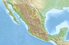
The 1982 Ometepec earthquake that struck Mexico's southwestern coast near Ometepec (Guerrero) on 7 June was a doublet earthquake that ruptured in two steps. The first happened at 06:52 UTC, the second five hours later at 10:59 UTC. Estimated magnitudes are 6.9 and 7.0 on the Ms scale, and 5.8 and 6.0 on the mb scale.[9] The maximum Mercalli intensities were VII and VIII, respectively.[10]
Mexico's southwestern coast is parallel to the 3,000 km (1,900 mi) Middle America Trench (MAT), where the oceanic
The interruption of the main rupture that results in a doublet earthquake has been attributed to "asperities", patches in the fault where harder rock resists immediate rupture. However, study of this earthquake's aftershocks shows a discontinuity in their spatial distribution.[14] This has been interpreted as indicating a split in the subducting plate, where the plate is subducting at slightly different down angles on either side of the split.[15]
Notes
- ^ ISC-EHB Event 596705 [IRIS].
- ^ Astiz & Kanamori 1984.
- ^ ISC-EHB Event 596720 [IRIS].
- ^ Astiz & Kanamori 1984.
- ^ ISC-EHB Event 596705 [IRIS].
- ^ ISC-EHB Event 596720 [IRIS].
- ^ ANSS: Mexico 1982b .
- ^ "Event: OAXACA, MEXICO". ngdc.noaa.gov.
- ^ ISC-EHB Event 596705 [IRIS]. ISC-EHB Event 596720 [IRIS]. Astiz & Kanamori 1984.
- ^ ANSS: Mexico 1982a, ShakeMap . ANSS: Mexico 1982b, ShakeMap .
- ^ Astiz & Kanamori 1984, p. 26.
- ^ Yamamoto et al. 2013, p. 375.
- ^ Yamamoto et al. 2013, p. 379.
- ^ Yamamoto, Quintanar & Jiménez 2002, p. 131.
- ^ Yamamoto, Quintanar & Jiménez 2002, p. 138.
Sources
- ANSS, "Mexico 1982a: M 6.9 – Oaxaca, Mexico", Comprehensive Catalog, U.S. Geological Survey
- ANSS, "Mexico 1982b: M 7.0 – Guerrero, Mexico", Comprehensive Catalog, U.S. Geological Survey
- International Seismological Centre, ISC-EHB Bulletin, Thatcham, United Kingdom
- Astiz, Luciana; Kanamori, Hiroo (1984), "An earthquake doublet in Ometepec, Guerrero, Mexico." (PDF), Physics of the Earth and Planetary Interiors, 34 (1–2): 24–45, .
- Yamamoto, Jaime; Quintanar, Luis; Jiménez, Zenón (2002), "Why earthquake doublets in the Ometepec, Guerrero, Mexico subduction area?", Physics of the Earth and Planetary Interiors, 132 (1–3): 131–139, .
- Yamamoto, Jaime; González-Moran, Tomas; Quintanar, Luis; Zavaleta, Ana B.; Zamora, Araceli; Espindola, Victor H. (January 2013), "Seismic patterns of the Guerrero–Oaxaca, Mexico region, and its relationship to the continental margin structure", Geophysical Journal International, 192 (1): 375–389, .
See also
- The International Seismological Centre has a bibliography and/or authoritative data for this event.

