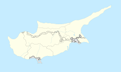
Agios Andronikos
Agios Andronikos
| |
|---|---|
| Coordinates: 35°30′13″N 34°09′53″E / 35.50361°N 34.16472°E | |
| Country (de jure) | |
| • District | Famagusta District |
| Country (de facto) | |
| • District | İskele District |
| Population (2011)[2] | |
| • Total | 799 |
| Climate | Csa |
Agios Andronikos (
.Prior to 1974, Agios Andronikos had a mixed
Turkish Cypriot population. The Greek Cypriots constituted a majority. Though only a small number of the village's Greek Cypriot inhabitants fled during the Turkish invasion of Cyprus, nearly all of them left for the south of the island by mid-1976.[3] As of 2011[update]
, Agios Andronikos had a population of 799.
References
- ^ In 1983, the Turkish Republic of Northern Cyprus unilaterally declared independence from the Republic of Cyprus. The de facto state is not recognised by any UN state except Turkey.
- ^ "KKTC 2011 Nüfus ve Konut Sayımı" [TRNC 2011 Population and Housing Census] (PDF) (in Turkish). TRNC State Planning Organization. 6 August 2013. Archived from the original (PDF) on 6 November 2013.
- PRIO Cyprus Centre. Retrieved 24 November 2014.


