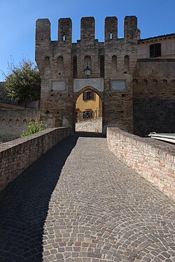
Agugliano
Agugliano | |
|---|---|
| Comune di Agugliano | |
 Castel d'Emilio | |
UTC+2 (CEST) | |
| Postal code | 60020 |
| Dialing code | 071 |
| Website | Official website |
Agugliano is a comune (municipality) in the Province of Ancona in the Italian region Marche, located about 13 kilometres (8 mi) southwest of Ancona.
Agugliano borders the following municipalities: Ancona, Camerata Picena, Jesi, Polverigi.
References
- ^ "Superficie di Comuni Province e Regioni italiane al 9 ottobre 2011". Italian National Institute of Statistics. Retrieved 16 March 2019.
- Istat.
External links

