
Al-Ras, Tulkarm
al-Ras | |
|---|---|
Village council | |
| Population (2017)[1] | |
| • Total | 650 |
| Name meaning | The hill–top[2] |
al-Ras (
History
Ceramics from the Byzantine era have been found here.[5]
Seven ruins are shown on the plan north of this village within about a mile. They are ancient watch towers, like those of Azzun.[6] One of them, known as Gasr Bint esh-Sheikh, dates from the late Hellenistic and early Roman periods.[7][8]
Ottoman era
Al-Ras was incorporated into the
In 1838, Robinson noted er-Ras as a village in Beni Sa'ab district, west of Nablus.[10]
In 1870/1871 (1288
In 1882 the PEF's Survey of Western Palestine (SWP) described Er Ras as: "a small hamlet on a high knoll, supplied by cisterns, with olives below on the north."[12]
British Mandate era
In the 1922 census of Palestine conducted by the British Mandate authorities, Ras had a population of 92 Muslims,[13] increasing in the 1931 census to 119 Muslims, living in 26 houses.[14]
In the 1945 statistics the population of Er Ras was 160 Muslims,[15] with 5,646 dunams of land according to an official land and population survey.[16] Of this, 1,029 dunams were plantations and irrigable land, 2,027 were used for cereals,[17] while 3 dunams were built-up (urban) land.[18]
-
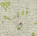 Al-Ras 1942 1:20,000
 -
 Al-Ras 1945 1:250,000


Jordanian era
In the wake of the 1948 Arab–Israeli War, and after the 1949 Armistice Agreements, Al-Ras came under Jordanian rule.
In 1961, the population of Al-Ras was 269.[19]
Post 1967
Since the Six-Day War in 1967, Al-Ras has been under Israeli occupation.
References
- ^ a b Preliminary Results of the Population, Housing and Establishments Census, 2017 (PDF). Palestinian Central Bureau of Statistics (PCBS) (Report). State of Palestine. February 2018. pp. 64–82. Retrieved 2023-10-24.
- ^ Palmer, 1881, p. 189
- ^ Palestinian Population by Locality and Refugee Status Archived 2012-02-07 at the Wayback Machine Palestinian Central Bureau of Statistics
- ^ Health care Facilities Tulkarm Governorate
- ^ Dauphin, 1998, p. 769
- ^ Conder and Kitchener, 1882, SWP II, p. 210
- ISBN 978-3-11-086694-0, retrieved 2023-04-11
- ISSN 0031-0328.
- ^ Hütteroth and Abdulfattah, 1977, p. 141
- ^ Robinson and Smith, 1841, vol 3, Appendix 2, p. 127
- ^ Grossman, David (2004). Arab Demography and Early Jewish Settlement in Palestine. Jerusalem: Magnes Press. p. 255.
- ^ Conder and Kitchener, 1882, SWP II, p. 166
- ^ Barron, 1923, Table XI, Sub-district of Tulkarm, p. 27
- ^ Mills, 1932, p. 56
- ^ Government of Palestine, Department of Statistics, 1945, p. 21
- ^ Government of Palestine, Department of Statistics. Village Statistics, April, 1945. Quoted in Hadawi, 1970, p. 76
- ^ Government of Palestine, Department of Statistics. Village Statistics, April, 1945. Quoted in Hadawi, 1970, p. 127
- ^ Government of Palestine, Department of Statistics. Village Statistics, April, 1945. Quoted in Hadawi, 1970, p. 177
- ^ Government of Jordan, 1964, p. 27
Bibliography
- Barron, J.B., ed. (1923). Palestine: Report and General Abstracts of the Census of 1922. Government of Palestine.
- Conder, C.R.; Kitchener, H.H. (1882). The Survey of Western Palestine: Memoirs of the Topography, Orography, Hydrography, and Archaeology. Vol. 2. London: Committee of the Palestine Exploration Fund.
- ISBN 0-860549-05-4.
- Government of Jordan, Department of Statistics (1964). First Census of Population and Housing. Volume I: Final Tables; General Characteristics of the Population (PDF).
- Government of Palestine, Department of Statistics (1945). Village Statistics, April, 1945.
- Hadawi, S. (1970). Village Statistics of 1945: A Classification of Land and Area ownership in Palestine. Palestine Liberation Organization Research Center. Archived from the original on 2018-12-08. Retrieved 2014-09-12.
- Hütteroth, Wolf-Dieter; Abdulfattah, Kamal (1977). Historical Geography of Palestine, Transjordan and Southern Syria in the Late 16th Century. Erlanger Geographische Arbeiten, Sonderband 5. Erlangen, Germany: Vorstand der Fränkischen Geographischen Gesellschaft. ISBN 3-920405-41-2.
- Mills, E., ed. (1932). Census of Palestine 1931. Population of Villages, Towns and Administrative Areas. Jerusalem: Government of Palestine.
- Palmer, E.H. (1881). The Survey of Western Palestine: Arabic and English Name Lists Collected During the Survey by Lieutenants Conder and Kitchener, R. E. Transliterated and Explained by E.H. Palmer. Committee of the Palestine Exploration Fund.
- Robinson, E.; Smith, E. (1841). Biblical Researches in Palestine, Mount Sinai and Arabia Petraea: A Journal of Travels in the year 1838. Vol. 3. Boston: Crocker & Brewster.
External links
- Welcome To al-Ras
- Survey of Western Palestine, Map 11: IAA, Wikimedia commons
|  | |||
| Municipalities | ||||
Villages | ||||
Refugee camps |
| |||