
Algoma, Mississippi
Algoma, Mississippi | ||
|---|---|---|
 The Algoma water tower in Algoma, Mississippi. Photo by Michael Jones. | ||
|
FIPS code 28-00820 | | |
| GNIS feature ID | 0666194 | |
Algoma is a town in
Algoma is a Native American[clarification needed] word meaning "vale of flowers".[citation needed]
Geography
Algoma is located at 34°10′32″N 89°01′56″W / 34.175574°N 89.032126°W.[2]
According to the United States Census Bureau, the town has a total area of 6.6 square miles (17 km2), of which 6.6 square miles (17 km2) is land and 0.04 square miles (0.10 km2) (0.60%) is water.
Climate
The climate in this area is characterized by hot, humid summers and generally mild to cool winters. According to the
Demographics
2020 census
As of 2020, there were 705 people, 333 households, and 234 families residing in the town.[4]
2000 census
As of the
There were 203 households, out of which 33.5% had children under the age of 18 living with them, 61.6% were married couples living together, 13.8% had a female householder with no husband present, and 22.7% were non-families. 20.7% of all households were made up of individuals, and 9.4% had someone living alone who was 65 years of age or older. The average household size was 2.50 and the average family size was 2.90.
| Census | Pop. | Note | %± |
|---|---|---|---|
| 1990 | 420 | — | |
| 2000 | 508 | 21.0% | |
| 2010 | 590 | 16.1% | |
| 2020 | 705 | 19.5% | |
| U.S. Decennial Census[6] | |||
In the town, the population was spread out, with 25.0% under the age of 18, 9.3% from 18 to 24, 29.7% from 25 to 44, 21.5% from 45 to 64, and 14.6% who were 65 years of age or older. The median age was 36 years. For every 100 females, there were 88.8 males. For every 100 females age 18 and over, there were 85.9 males.
The median income for a household in the town was $32,333, and the median income for a family was $38,250. Males had a median income of $24,625 versus $18,750 for females. The
Education
The town of Algoma is served by the Pontotoc County School District.[7]
Algoma Cross Tie Festival
The first weekend in October Algoma has its annual "Algoma Cross Tie Festival". This festival is open for all people with live local music, auction, car and tractor show, and selling booths. The Cross-Tie Festival was originally begun in reference to the H. B. Owen Cross-Tie Factory. It was owned by Hardiman Brackett Owen in Algoma, Pontotoc Co., MS. The factory was one of the south's largest industries. Algoma still celebrates with "The Cross-Tie Festival" each year.
Notable people
- Leroy Foster, blues musician.[8]
References
- ^ "2020 U.S. Gazetteer Files". United States Census Bureau. Retrieved July 24, 2022.
- ^ "US Gazetteer files: 2010, 2000, and 1990". United States Census Bureau. February 12, 2011. Retrieved April 23, 2011.
- ^ Climate Summary for Algoma, Mississippi
- ^ "Algoma town, Mississippi". United States Census Bureau. Retrieved April 15, 2023.
- ^ "U.S. Census website". United States Census Bureau. Retrieved January 31, 2008.
- ^ "Census of Population and Housing". Census.gov. Retrieved June 4, 2015.
- ISBN 9781556529825.
Municipalities and communities of Pontotoc County, Mississippi, United States | ||
|---|---|---|
| City | 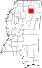 | |
| Towns | ||
| CDP | ||
| Other communities |
| |
| Footnotes | ‡This populated place also has portions in an adjacent county or counties | |
| ||