
Altamahaw, North Carolina
Altamahaw, North Carolina | ||
|---|---|---|
FIPS code 37-01150[5] | | |
| GNIS feature ID | 2402639[3] | |
Altamahaw is a
History
The Altamahaw Mill Office was added to the National Register of Historic Places in 1984.[8]
Geography
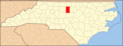
Altamahaw is located off State Route 87 about 7 miles (11 km) north of the city of Burlington.
According to the United States Census Bureau, the CDP has a total area of 1.4 square miles (3.6 km2), of which 1.4 square miles (3.5 km2) is land and 0.039 square miles (0.1 km2), or 2.56%, is water.[6]
Demographics
| Census | Pop. | Note | %± |
|---|---|---|---|
| 2020 | 334 | — | |
| U.S. Decennial Census[9] | |||
As of the
There were 399 households, out of which 35.3% had children under the age of 18 living with them, 52.6% were married couples living together, 11.3% had a female householder with no husband present, and 30.6% were non-families. 26.8% of all households were made up of individuals, and 11.8% had someone living alone who was 65 years of age or older. The average household size was 2.50 and the average family size was 3.04.
In the CDP, the population was spread out, with 26.4% under the age of 18, 6.6% from 18 to 24, 32.3% from 25 to 44, 23.1% from 45 to 64, and 11.5% who were 65 years of age or older. The median age was 37 years. For every 100 females there were 95.7 males. For every 100 females age 18 and over, there were 89.4 males.
The median income for a household in the CDP was $35,375, and the median income for a family was $46,250. Males had a median income of $24,250 versus $19,228 for females. The
References
- ^ "North Carolina Gazetteer". Retrieved November 24, 2023.
- ^ "ArcGIS REST Services Directory". United States Census Bureau. Retrieved September 20, 2022.
- ^ a b c U.S. Geological Survey Geographic Names Information System: Altamahaw, North Carolina
- ^ "Altamahaw NC ZIP Code". zipdatamaps.com. 2023. Retrieved February 17, 2023.
- ^ a b "U.S. Census website". United States Census Bureau. Retrieved 2008-01-31.
- ^ a b "Geographic Identifiers: 2010 Demographic Profile Data (G001): Altamahaw CDP, North Carolina". U.S. Census Bureau, American Factfinder. Retrieved July 1, 2013.[dead link]
- ^ U.S. Census Geographic Change Notes, retrieved 17 May 2010
- ^ "National Register Information System". National Register of Historic Places. National Park Service. July 9, 2010.
- ^ "Census of Population and Housing". Census.gov. Retrieved June 4, 2016.
 | ||||
Towns | ||||
Village | ||||
| CDPs | ||||
| Other communities | ||||
| Footnotes | ‡This populated place also has portions in an adjacent county or counties | |||
| ||||
| Authority control databases: Geographic |
|---|