
Graham, North Carolina
Graham, North Carolina | ||
|---|---|---|
 | ||
|
FIPS code 37-27280[4] | | |
| GNIS feature ID | 2403722[3] | |
| Website | www | |
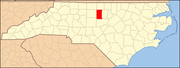
Graham is a city in
History
Graham was laid out in 1849 as the county seat of the newly formed Alamance County, and was incorporated as a town in 1851; it became a city in 1961. It was named for
The lynching of
National Register of Historic Places
Alamance County Courthouse, Cedarock Park Historic District, Graham Historic District, William P. Morrow House, North Main Street Historic District, and Oneida Cotton Mills and Scott-Mebane Manufacturing Company Complex are listed on the National Register of Historic Places.[9][10]
Geography
Graham is bordered to the north and the west by the city of Burlington and to the northeast by the town of Haw River. The Haw River runs along the east edge of Graham, and the city extends south as far as Alamance Creek. Interstate 85 runs through the city, leading east to Durham and west to Greensboro.
According to the United States Census Bureau, the city has a total area of 9.7 square miles (25.1 km2), of which 9.6 square miles (24.9 km2) is land and 0.077 square miles (0.2 km2), or 0.67%, is water.[11]
Climate
The climate in this area is characterized by relatively high temperatures and evenly distributed precipitation throughout the year. According to the
Education
The local school system is known as the Alamance-Burlington School System, which was created by a merger between the Alamance County School System and the Burlington City School System in 1996.
Local public schools in Graham include:
- Southern Alamance High School
- Graham High School
- Graham Middle School
- Southern Middle School
- Alexander Wilson Elementary School
- B. Everett Jordan Elementary School
- North Graham Elementary School
- South Graham Elementary School
Private schools include:
- Alamance Christian School
Graham is also home to Alamance Community College, a two-year technical college.
Demographics
| Census | Pop. | Note | %± |
|---|---|---|---|
| 1870 | 502 | — | |
| 1880 | 379 | −24.5% | |
| 1890 | 991 | 161.5% | |
| 1900 | 2,052 | 107.1% | |
| 1910 | 2,504 | 22.0% | |
| 1920 | 2,366 | −5.5% | |
| 1930 | 2,972 | 25.6% | |
| 1940 | 4,339 | 46.0% | |
| 1950 | 5,026 | 15.8% | |
| 1960 | 7,723 | 53.7% | |
| 1970 | 8,172 | 5.8% | |
| 1980 | 8,674 | 6.1% | |
| 1990 | 10,426 | 20.2% | |
| 2000 | 12,833 | 23.1% | |
| 2010 | 14,153 | 10.3% | |
| 2020 | 17,153 | 21.2% | |
| 2022 (est.) | 17,856 | [13] | 4.1% |
| U.S. Decennial Census[14][15] | |||
2020 census
| Race | Number | Percentage |
|---|---|---|
White (non-Hispanic)
|
8,420 | 49.08% |
Black or African American (non-Hispanic)
|
4,426 | 25.8% |
Native American
|
82 | 0.48% |
Asian
|
222 | 1.29% |
Pacific Islander
|
6 | 0.03% |
Other/Mixed
|
788 | 4.59% |
Latino
|
3,213 | 18.73% |
As of the 2020 United States census, there were 17,157 people, 6,412 households, and 3,962 families residing in the city.
2000 census
At the
The age distribution was 24.0% under the age of 18, 9.9% from 18 to 24, 31.8% from 25 to 44, 20.1% from 45 to 64, and 14.1% 65 or older. The median age was 34 years. For every 100 females, there were 90.1 males. For every 100 females age 18 and over, there were 86.4 males.
The median household income was $35,706 and the median family income was $40,769. Males had a median income of $27,844 versus $22,163 for females. The per capita income for the city was $17,865. About 11.9% of families and 14.9% of the population were below the
References
- ^ "North Carolina Gazetteer". Retrieved November 24, 2023.
- ^ "ArcGIS REST Services Directory". United States Census Bureau. Retrieved September 20, 2022.
- ^ a b U.S. Geological Survey Geographic Names Information System: Graham, North Carolina
- ^ a b "U.S. Census website". United States Census Bureau. Retrieved January 31, 2008.
- ^ "City and Town Population Totals: 2020-2021". Census.gov. US Census Bureau. Retrieved July 9, 2022.
- ^ "Find a County". National Association of Counties. Archived from the original on May 31, 2011. Retrieved June 7, 2011.
- ^ Troxler, Carole Watterson and William Murray Vincent (1999). Shuttle & Plow: A History of Alamance County, North Carolina. Alamance County Historical Association.
- ^ The Hillsboro Recorder, April 6, 1870.
- ^ "National Register Information System". National Register of Historic Places. National Park Service. July 9, 2010.
- ^ "National Register of Historic Places Listings". Weekly List of Actions Taken on Properties: 6/09/14 through 6/13/14. National Park Service. June 20, 2014.
- ^ "Geographic Identifiers: 2010 Demographic Profile Data (G001): Graham city, North Carolina". U.S. Census Bureau, American Factfinder. Archived from the original on February 12, 2020. Retrieved June 28, 2013.
- ^ Climate Summary for Graham, North Carolina
- ^ "Annual Estimates of the Resident Population for Incorporated Places in North Carolina: April 1, 2020 to July 1, 2022". Census.gov. Retrieved April 19, 2024.
- ^ "Census of Population and Housing". Census.gov. Retrieved June 4, 2015.
- ^ "Census of Population and Housing". Census.gov. Retrieved June 4, 2016.
- ^ "Explore Census Data". data.census.gov. Retrieved December 20, 2021.
External links

 | ||||
Towns | ||||
Village | ||||
| CDPs | ||||
| Other communities | ||||
| Footnotes | ‡This populated place also has portions in an adjacent county or counties | |||
| ||||
| International | |
|---|---|
| National | |
| Other | |