
Amselsee
| Amselsee | |
|---|---|
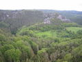
.JPG) View over the Amselsee | |
| Location | Saxon Switzerland |
| Coordinates | 50°57′52″N 14°04′53″E / 50.96444°N 14.08139°E |
| Construction began | 1934 |
| Dam and spillways | |
| Impounds | Grünbach |
| Height (thalweg) | 5.5 m (18 ft) (with parapet wall) |
| Length | 38 m (125 ft) |
| Width (crest) | 1.2 m (3 ft 11 in) |
| Reservoir | |
| Active capacity | 19,600 m3 (15.9 acre⋅ft) |
| Surface area | 0.012 ha (0.030 acres) |
| Maximum length | 0.55 m (1 ft 10 in) |
| Normal elevation | 125.7 m (412 ft) |
The Amselsee (also Amselsee Rathen) is a small
Free State of Saxony
in Eastern Germany.
Reservoir
To create the Amselsee in
flood prevention. Round trips have been possible since 1969. The trout stock is sometimes mixed with American rainbow trout. Amongst the lakeside vegetation broad-winged damselflies
or demoiselles may be seen.
Dam
The barrier is a straight
rubble stone masonry. It was built in 1934 and taken into service in 1935. According to an article in the Sächsische Zeitung of 31 July 2004 the period of construction lasted from 21 July 1934 to 19 December 1934. It has a drainage outlet with a diameter of 50 cm and a flood spillway
with 7 openings, each 2 m wide, in the centre of the dam.
Gallery
-
 The Amselgrund with the Amselsee, Lokomotive and the Talwächter
 -
 View of the dam

.JPG)
External links
Wikimedia Commons has media related to Amselsee.