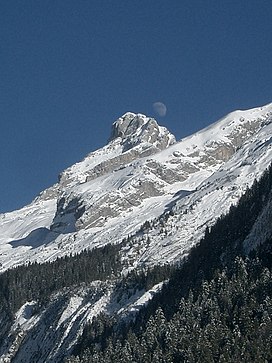
Aravis Range
| Aravis Range | |
|---|---|
 Pointe Percée | |
| Highest point | |
| Peak | Pointe Percée |
| Elevation | 2,753 m (9,032 ft) |
| Coordinates | 45°57′21″N 6°33′20″E / 45.95583°N 6.55556°E |
| Naming | |
| Native name | Chaîne des Aravis (French) |
| Geography | |
| Country | France |
| Department | Savoie and Haute-Savoie |
| Parent range | French Prealps |
| Borders on | Chablais and Graian Alps |
| Geology | |
| Type of rock | Sedimentary |
The Aravis (
Bornes massif, sometimes considered part of the Aravis, lies to its west. The Aravis is separated from the Chablais mountains in the north-east by the Arve river valley, and from the Graian Alps in the south-east by the Arly
river valley.
Peaks
- Pointe Percée, 2,753 m (9,032 ft)
- Grande Balmaz, 2,616 m (8,583 ft)
- Roualle, 2,589 m (8,494 ft)
- Parrossaz, 2,556 m (8,386 ft)
- Mont Charvet, 2,538 m (8,327 ft)
- Roche Perfia, 2,499 m (8,199 ft)
- Aiguille de Borderan, 2,489 m (8,166 ft)
- Étale (mountain), 2,484 m (8,150 ft)
- Pointe d'Areu, 2,478 m (8,130 ft)
- Mont Charvin, 2,409 m (7,904 ft)
References
- Bouvier, L. (1866). La Chaine des Aravis: topographie botanique, histoire and statistique des vallées de La Clusaz, du Grand-Bornand, du Reposoir, et de Thônes (in French). Imprimerie de Louis Thesio. Retrieved 2022-07-10.
Wikimedia Commons has media related to Chaîne des Aravis.

