Ardmeanach
Appearance
This article relies largely or entirely on a single source. (March 2020) |
Ardmeanach
Scottish Gaelic: Ard Meanach | |
|---|---|
 Looking out towards Inch Kenneth and Ulva | |
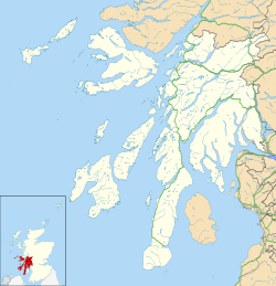
Ardmeanach within Argyll and Bute | |
| Coordinates: 56°23′N 6°07′W / 56.39°N 6.12°W | |
| Location | Argyll and Bute, Scotland |
| Part of | Isle of Mull |
Ardmeanach (
Loch Na Keal
.
It is mountainous and includes Ben More, the highest mountain on the island. It is largely uninhabited, with a few isolated settlements along the coast. It is cut in two by a narrow valley (Gleann Seilisdeir) which runs north–south between the two sea lochs and carries the B8035 road. The peninsula (or its western end) is a Special Area of Conservation.
References
- ^ "The Lost World of Mull". Walk Highlands.


