
Arthur's Pass (mountain pass)
| Arthur's Pass | ||
|---|---|---|
Elevation 920 m (3,018 ft) | | |
| Traversed by | State Highway 73 | |
| Location | New Zealand | |
| Range | Southern Alps | |
| Coordinates | 42°54′11.272″S 171°33′42.221″E / 42.90313111°S 171.56172806°E | |
Arthur's Pass is a
A
History
For hundreds of years
In 1860 writer and explorer Samuel Butler had seen a pass at the head of the Bealey Valley, but was travelling alone and did not want to leave his horse unattended so "shirked investigation".[3]
In 1864 Arthur Dudley Dobson (1841–1934) along with his brother Edward were the first Europeans to cross the pass. In 1863 Dobson went to the mostly unexplored West Coast for seven months of survey work. His area of work extended from the Grey River to Abut Head, and inland up to the Main Divide. His brother Edward, meanwhile, was clearing a rough track over Harper Pass. Arthur Dobson returned to Christchurch and reported his findings to the chief surveyor, Thomas Cass.[4]

Cass then commissioned Arthur Dobson in 1864 to find out whether there was a suitable pass from the Waimakariri watershed to the West Coast. George and Arthur Dobson set out in March 1864, later to be joined by their brother Edward at Craigieburn. While George surveyed road lines there, Edward and Arthur proceeded to explore the high country. On 13 March 1864 they found the pass mentioned by Tarapuhi to Harper, which steeply descended to what became known as Otira. They explored the gorge as far as the junction of the Rolleston River, but saw no good sheep country so retraced their steps.[5] Arthur prepared a report, which included a sketch of the pass which he described as the "Arahura Saddle", thinking it led to the Arahura River, and presented it to Cass.[6][7]
Soon after, the discovery of gold triggered the
Road link
State Highway 73 passes over Arthur's Pass and is the highest of only three roads crossing the Southern Alps, the other crossings being the Haast Pass and the Lewis Pass. However, Porters Pass, on the same road, is higher (at 939 m) than Arthur's Pass, but it is not considered one of the alpine passes, as it is located in the Canterbury foothills not far away from Springfield.
Previously prone to be blocked by landslides or avalanches, the road on the western side of the pass has seen extensive civil engineering work in the late 1990s. Most notably, the impressive Otira Viaduct, near the settlement of Otira and spanning 440 metres of unstable terrain, was completed in 1999.
Rail link
The Midland Line, connecting Christchurch and the West Coast, crosses the Main Divide by means of the Otira Tunnel, between Arthur's Pass township and Otira. When opened in 1923, the tunnel was the longest in the British Empire.
- Gallery
-
 Otira Viaduct
 -
 Memorial inscription
 -
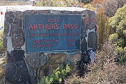
 Arthur's Pass
 -
 Boundary marker


References
- ^ "Map of the Westland District". Westland District Council. Archived from the original on 12 January 2010. Retrieved 7 January 2010.
- ^ a b Dennis 1986, p. 60–61.
- ^ Dennis 1986, p. 64–65.
- ^ a b c A. H. McLintock, ed. (22 April 2009) [originally published in 1966]. "Dobson Brothers". An Encyclopaedia of New Zealand. Ministry for Culture and Heritage / Te Manatū Taonga. Archived from the original on 12 June 2011. Retrieved 7 May 2011.
- ^ Dennis 1986, p. 66–67.
- ^ a b Starky, Suzanne. "Dobson, Edward". Dictionary of New Zealand Biography. Ministry for Culture and Heritage. Retrieved 7 May 2011.
- ^ a b New Zealand Ministry for Culture and Heritage (7 October 2020). "Arthur's Pass 'discovered'". New Zealand History. Retrieved 27 October 2020.
- ^ "A Canterbury Pioneer". The Press. Vol. LXXIII, no. 22070. 19 April 1937. p. 8. Retrieved 4 February 2022.
Bibliography
- Dennis, Andy (1986). The Story of Arthur's Pass National Park. Auckland: Department of Lands and Survey & Cobb/Horwood Publications. ISBN 0477061486.
- Reed, A. W. (2002). The Reed Dictionary of New Zealand Place Names. Auckland: Reed Books. ISBN 0-7900-0761-4.