Asari-Toru
Asari-Toru
Asalga | |
|---|---|
Buguma City | |
| Government | |
| • Local Government Chairman | Hon. Onengiyeofori George DSSRS (PDP) |
| • Deputy Local Government Chairman | Hon. (Mrs) Tekena Daphne Wokoma (PDP) |
| • Local Government Council | Ward 1: Telema P. George (PDP) Ward 2: Prince Batubo (PDP) Ward 3: Osimafamabia Telema Princewill (PDP) Ward 4: Amieyeofori Ernest Harry (PDP) Ward 5: Gold Gift Horsfall (PDP) Ward 6: Nyo West (PDP) Ward 7: Soibibo Tams Horsfall (PDP) Ward 8: Tamunomiete Atkinson Jackreece (PDP) Ward 9: Owanate Aforma West (PDP) Ward 10: Rachael Taylor Harry (PDP) Ward 11: Martins Kombo Obene (PDP) Ward 12: Fyneface Reginald Opakirite (PDP) Ward 13: Obufiya Sukubo (PDP)
John Paul Braide, Chief Press Secretary (PDP)
UTC+1 (WAT) |
| Nigeria Postal Code | 504101 |
 | |
Asari-Toru is a
General information
Asari-Toru
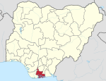
Asari-Toru is the “Seat” of the Ancestral Stool of the Kalabari Speaking Dynasty which cuts across Akuku-Toru and Degema Local Government Areas.[1]
The Local Government Area upon creation presently encompasses Seventeen (17) Communities namely:
- Buguma,
- Abalama,
- Abiama,
- Angulama,
- Atuka,
- Ido,
- Ifoko,
- Illelema,
- Krakrama,
- Minama,
- Okpo,
- Omekweama,
- Omekwetariama,
- Oporoama,
- Sama,
- Agama,
- Tema.
Buguma City is the Headquarters of the Local Government Area and Seat of the King of Kalabari Kingdom: His Royal Majesty, King (Prof.) T.J.T Princewill, Abbi the XI, Amayanabo of Kalabari Kingdom.[3]
These communities have been grouped into thirteen (13) electoral wards, ten (10) of these wards are within the capital, Buguma City; while the remaining are grouped into Isia Group I, Isia Group II and West Central Group.[4]
The local government area has an estimated area of 113 km2 and a population of 308,800 by projection of March 21, 2016.[5]
The postal code of the area is 504101 .[6]
References
- ^ a b "Towns & Villages". Towns & Villages. Retrieved 2023-05-12.
- ^ "Full results of Rivers State local goment elections". BBC News Pidgin. Retrieved 2021-12-05.
- ^ "What ASALGA Chairman said about Amanyanabo of Kalabari Stool". KRISTINA REPORTS. 2020-08-11. Retrieved 2023-05-02.
- ^ Tide, The (2009-06-24). "Know Your Wards ASALGA". :::...The Tide News Online:::... Retrieved 2023-05-02.
- ISSN 0017-5749.
- ^ "Post Offices- with map of LGA". NIPOST. Archived from the original on 7 October 2009. Retrieved 2009-10-20.

