
Atglen, Pennsylvania
This article needs additional citations for verification. (March 2013) |
Atglen, Pennsylvania | |
|---|---|
EDT) | |
| ZIP Code | 19310 |
| Area code(s) | 610 |
| FIPS code | 42-03384 |
| Website | http://www.atglen.org |
Atglen is a borough in Chester County, Pennsylvania, United States. According to the 2020 census, its population is 1,311.[3]
History

Present-day Atglen was originally a wilderness where
18th century
In 1717,
Drawn by the township's farmland during the mid-18th century, more settlers arrived to Atglen. The Native Americans' trails became horse tracks and later wagon tracks as farmers shipped their goods to market in Philadelphia; Newport, Delaware; and New Castle, Delaware. The old Provincial Highway, as authorized by the government, was laid out in 1730. Newport Road, leading to the ore mines at Cornwall in Lebanon County, was laid out in 1796.
In 1720, Presbyterians formed the area's earliest organized religious group: what is known today as the Upper Octorara Presbyterian Church. They were followed by the Quakers who in 1724 founded the Sadsbury Meeting House. A year later, English settlers formed St. John's Church.
Andrew Moore (1688–1753), who had been influential with Samuel Miller in founding Sadsbury Meeting House, built a tub mill on his property.
19th century
The original settlement in the town's current location was known as Penningtonville, and a post office by that name was established there in 1842. However, by the 1870s, the name Atglen was in common usage. In 1876, the court in West Chester made an official decree incorporating the village of Penningtonville as the "Borough of Atglen."[6]
Geography
Atglen is located at 39°56′53″N 75°58′26″W / 39.94806°N 75.97389°W (39.948106, -75.973887).[7]
According to the U.S. Census Bureau, the borough has a total area of 0.9 square miles (2.3 km2), all land.
Transportation
_just_south_of_Pennsylvania_State_Route_372_(Lower_Valley_Road)_in_Atglen,_Chester_County,_Pennsylvania.jpg)
As of 2020, there were 8.72 miles (14.03 km) of public roads in Atglen, of which 2.64 miles (4.25 km) were maintained by Pennsylvania Department of Transportation (PennDOT) and 6.08 miles (9.78 km) were maintained by the borough.[8]
Atglen is served by two numbered highways. Pennsylvania Route 41 follows Gap Newport Pike on a northwest-to-southeast alignment across the northeastern portion of the borough. Pennsylvania Route 372 follows Valley Road, Main Street and Lower Valley Road on an east-west alignment through the heart of the borough.
Demographics
| Census | Pop. | Note | %± |
|---|---|---|---|
| 1880 | 347 | — | |
| 1890 | 397 | 14.4% | |
| 1900 | 404 | 1.8% | |
| 1910 | 546 | 35.1% | |
| 1920 | 650 | 19.0% | |
| 1930 | 620 | −4.6% | |
| 1940 | 588 | −5.2% | |
| 1950 | 668 | 13.6% | |
| 1960 | 721 | 7.9% | |
| 1970 | 740 | 2.6% | |
| 1980 | 669 | −9.6% | |
| 1990 | 825 | 23.3% | |
| 2000 | 1,217 | 47.5% | |
| 2010 | 1,406 | 15.5% | |
| 2020 | 1,311 | −6.8% | |
| 2021 (est.) | 1,306 | [3] | −0.4% |
| [9][10][2] | |||
At the 2010 census, the borough was 85.6% White, 7.4% Black or African American, 0.1% Native American, 0.2% Asian, and 1.5% were two or more races. 5.8% of the population were of Hispanic or Latino ancestry.[11]
As of the 2000
There were 413 households, out of which 46.2% had children under the age of 18 living with them, 55.9% were married couples living together, 16.7% had a female householder with no husband present, and 23.2% were non-families. 17.9% of all households were made up of individuals, and 5.3% had someone living alone who was 65 years of age or older. The average household size was 2.95 and the average family size was 3.33.
The population in Atglen comprised 34.2% under the age of 18, 9.0% from 18 to 24, 32.4% from 25 to 44, 16.6% from 45 to 64, and 7.9% who were 65 years of age or older. The median age was 30 years. For every 100 females there were 94.7 males. For every 100 females age 18 and over, there were 89.8 males.
The median
-
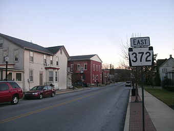 Rt 372
 -
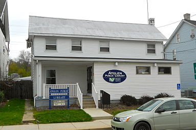 Atglen Library
 -
 Methodist Episcopal Church
 -
 Post Office
 -
 Bell from the original Municipal Building


Notable people
- Thomas J. Philips (1846–1939), member of the Pennsylvania House of Representatives[14]
- John A. Reynolds (1820–1889), member of the Pennsylvania House of Representatives[15]
References
- ^ "ArcGIS REST Services Directory". United States Census Bureau. Retrieved October 12, 2022.
- ^ a b "Census Population API". United States Census Bureau. Retrieved Oct 12, 2022.
- ^ a b Bureau, US Census. "City and Town Population Totals: 2020-2021". Census.gov. US Census Bureau. Retrieved 11 July 2022.
- ^ "History". www.atglen.org. Retrieved 2022-03-31.
- ^ Chester County Archives. "1721 Chester County Township Map". chesco.org.
- ^ "History".
- ^ "US Gazetteer files: 2010, 2000, and 1990". United States Census Bureau. 2011-02-12. Retrieved 2011-04-23.
- ^ "Atglen Borough map" (PDF). PennDOT. Retrieved March 12, 2023.
- ^ "Census 2020".
- ^ "Census of Population and Housing". Census.gov. Retrieved June 4, 2016.
- ^ "USA Today PA Census Profile". USA Today. Archived from the original on 2012-02-15. Retrieved 2017-08-24.
- ^ "U.S. Census website". United States Census Bureau. Retrieved 2008-01-31.
- ^ "Search Results".
- Archive.org.

- ^ "John A. Reynolds". Pennsylvania House of Representatives Archives. Retrieved 2023-12-22.
External links

| International | |
|---|---|
| National | |