
Atlantic Avenue station (BMT Canarsie Line)
Atlantic Avenue | |||||||||||||||||||||||||||||||||||||||||||||||||||||||||||||||||||||||||||||||||||||||||||||||||||||||||||||||||||||||||||||||||||||||||||||||||||||||||||||||||
|---|---|---|---|---|---|---|---|---|---|---|---|---|---|---|---|---|---|---|---|---|---|---|---|---|---|---|---|---|---|---|---|---|---|---|---|---|---|---|---|---|---|---|---|---|---|---|---|---|---|---|---|---|---|---|---|---|---|---|---|---|---|---|---|---|---|---|---|---|---|---|---|---|---|---|---|---|---|---|---|---|---|---|---|---|---|---|---|---|---|---|---|---|---|---|---|---|---|---|---|---|---|---|---|---|---|---|---|---|---|---|---|---|---|---|---|---|---|---|---|---|---|---|---|---|---|---|---|---|---|---|---|---|---|---|---|---|---|---|---|---|---|---|---|---|---|---|---|---|---|---|---|---|---|---|---|---|---|---|---|---|---|
| Rebuilt | 1916 (Dual Contracts) 2004 (CBTC) | ||||||||||||||||||||||||||||||||||||||||||||||||||||||||||||||||||||||||||||||||||||||||||||||||||||||||||||||||||||||||||||||||||||||||||||||||||||||||||||||||
| Opposite- direction transfer | Yes | ||||||||||||||||||||||||||||||||||||||||||||||||||||||||||||||||||||||||||||||||||||||||||||||||||||||||||||||||||||||||||||||||||||||||||||||||||||||||||||||||
| Former/other names | Atlantic Avenue – East New York Avenue[4] | ||||||||||||||||||||||||||||||||||||||||||||||||||||||||||||||||||||||||||||||||||||||||||||||||||||||||||||||||||||||||||||||||||||||||||||||||||||||||||||||||
| Traffic | |||||||||||||||||||||||||||||||||||||||||||||||||||||||||||||||||||||||||||||||||||||||||||||||||||||||||||||||||||||||||||||||||||||||||||||||||||||||||||||||||
| 2023 | 351,212[5] | ||||||||||||||||||||||||||||||||||||||||||||||||||||||||||||||||||||||||||||||||||||||||||||||||||||||||||||||||||||||||||||||||||||||||||||||||||||||||||||||||
| Rank | 408 out of 423[5] | ||||||||||||||||||||||||||||||||||||||||||||||||||||||||||||||||||||||||||||||||||||||||||||||||||||||||||||||||||||||||||||||||||||||||||||||||||||||||||||||||
| |||||||||||||||||||||||||||||||||||||||||||||||||||||||||||||||||||||||||||||||||||||||||||||||||||||||||||||||||||||||||||||||||||||||||||||||||||||||||||||||||
| |||||||||||||||||||||||||||||||||||||||||||||||||||||||||||||||||||||||||||||||||||||||||||||||||||||||||||||||||||||||||||||||||||||||||||||||||||||||||||||||||
| |||||||||||||||||||||||||||||||||||||||||||||||||||||||||||||||||||||||||||||||||||||||||||||||||||||||||||||||||||||||||||||||||||||||||||||||||||||||||||||||||
| |||||||||||||||||||||||||||||||||||||||||||||||||||||||||||||||||||||||||||||||||||||||||||||||||||||||||||||||||||||||||||||||||||||||||||||||||||||||||||||||||
| |||||||||||||||||||||||||||||||||||||||||||||||||||||||||||||||||||||||||||||||||||||||||||||||||||||||||||||||||||||||||||||||||||||||||||||||||||||||||||||||||
| |||||||||||||||||||||||||||||||||||||||||||||||||||||||||||||||||||||||||||||||||||||||||||||||||||||||||||||||||||||||||||||||||||||||||||||||||||||||||||||||||


The Atlantic Avenue station is a rapid transit station on the BMT Canarsie Line of the New York City Subway. Located at the intersection of Atlantic and Snediker Avenues at East New York, Brooklyn, it is served by the L train at all times.
History
Atlantic Avenue opened July 4, 1889, for the
Plans for the Interborough Express, a light rail line using the Bay Ridge Branch right of way, were announced in 2023.[7] As part of the project, a light rail station at Atlantic Avenue has been proposed next to the existing subway station.[8][9]
Dual Contracts rebuild

| 4 Platform level |
Northbound | ← Fulton Street Line (through service to Jamaica Line) |
| Island platform | ||
| Northbound | ← Canarsie Line | |
| Northbound | ← Fulton Street Line | |
| Island platform | ||
| Bidirectional | ← Fulton Street Line (peak direction) → | |
| Southbound | Fulton Street Line → Canarsie and Fulton Street Lines (through service from Jamaica Line) → | |
| Island platform | ||
| Southbound | → Canarsie Line → | |
| 3 | Mezzanine | |
| 2 | Atlantic Avenue roadway | |
| G | Street level | Exit/entrance |
| B1 | East New York LIRR
| |
Rebuilt and reconfigured under the
Current layout
| P Platform level |
Trackbed | No service |
| Island platform, not in service | ||
| Trackbed | No service | |
| Westbound | ← (No service: Broadway Junction/Jamaica) | |
| Island platform | ||
| Eastbound | | |
| M | Mezzanine | Fare control, station agent |
| G | Street level | Exit/entrance, stairs to East New York LIRR station |
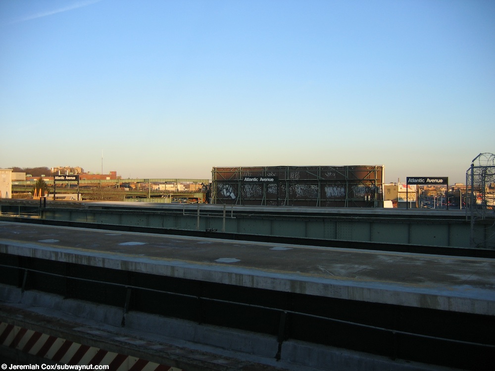
After the remaining portion of the Fulton Street el was removed in 1956, the Canarsie line continued to use the westernmost track and platform southbound, and the second track from the east and platform (over Snediker Avenue) northbound. The easternmost track was removed, leaving five in place.[10]
The westernmost platform is now the only one in service with both tracks in use. The former southbound Fulton el track is now the northbound track, and was connected to the existing Canarsie Line north of
North of the station, a single track diverges northeast to
The station was renovated in 2015–2016.
Exits
The station's only exit point is through the mezzanine. Two conjoined stairways lead from opposite ends of the north portion of the mezzanine, meeting in a combined landing before splitting off into two small stairs to the southeast corner of Atlantic Avenue and East New York Avenue.[12] Another stair, leading from the portion of the mezzanine that is underneath the easternmost platform, leads down to the southwest corner of Atlantic and Snediker Avenues.[12]
References
- ^ "Glossary". Second Avenue Subway Supplemental Draft Environmental Impact Statement (SDEIS) (PDF). Vol. 1. Metropolitan Transportation Authority. March 4, 2003. pp. 1–2. Archived from the original (PDF) on February 26, 2021. Retrieved January 1, 2021.
- Newspapers.com.

- ^ Atlantic Avenue; BMT Canarsie Line (NYCSubway.org)
- ^ "Subway Car Catches Fire" (PDF). The New York Times. July 30, 1946. Retrieved July 16, 2016.
- ^ a b "Annual Subway Ridership (2018–2023)". Metropolitan Transportation Authority. 2023. Retrieved April 20, 2024.
- ^ "First Leg of Rockaways Transit Opened at Cost of $10,154,702" (PDF). The New York Times. April 30, 1956. Retrieved June 29, 2015.
- ^ Brachfeld, Ben (January 10, 2024). "Interborough Express light rail project, which will connect Bay Ridge and Jackson Heights, inches forward". Brooklyn Paper. Retrieved January 26, 2024.
- ^ "MTA launches RFP for Interborough Express to link Brooklyn and Queens". News 12 - Default. October 29, 2024. Retrieved January 31, 2025.
- ^ "The Interborough Express: Planning & Environmental Linkages Study". MTA. January 2023.
- ^ a b "Broadway Junction Transportation Study: NYC Department of City Planning Final Report-November 2008" (PDF). nyc.gov. New York City Department of City Planning. November 2008. Archived (PDF) from the original on June 6, 2010. Retrieved October 27, 2015.
- ^ "Abandoned BMT Fulton Street Line Platforms (The Subway Nut)". Archived from the original on March 3, 2016. Retrieved March 13, 2011.
- ^ a b "MTA Neighborhood Maps: Ocean Hill" (PDF). mta.info. Metropolitan Transportation Authority. 2015. Retrieved July 19, 2015.
External links
- nycsubway.org – BMT Canarsie Line: Atlantic Avenue
- Station Reporter — L Train
- The Subway Nut — Atlantic Avenue Pictures
- Atlantic Avenue entrance from Google Maps Street View
- Williams Place and Atlantic Avenue exit only stairs from Google Maps Street View
- Platforms from Google Maps Street View
Canarsie Local |
|
|---|---|
| |
| Canarsie Line |
|
|---|---|
| |