
Bärenthal
Bärenthal | |
|---|---|
 Aerial view of Bärenthal | |
 Coat of arms | |
Location of Bärenthal within Tuttlingen district 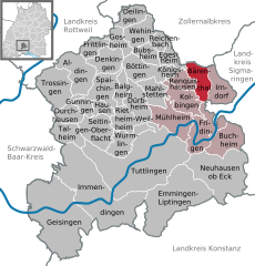 | |
 Bärenthal  Bärenthal | |
| Coordinates: 48°04′25″N 08°55′40″E / 48.07361°N 8.92778°E | |
| Country | Germany |
| State | Baden-Württemberg |
| Admin. region | Freiburg |
| District | Tuttlingen |
| Government | |
| • Mayor (2023–31) | Morris Stoupal[1] |
| Area | |
| • Total | 12.69 km2 (4.90 sq mi) |
| Elevation | 669 m (2,195 ft) |
| Population (2022-12-31)[2] | |
| • Total | 495 |
| • Density | 39/km2 (100/sq mi) |
| Time zone | UTC+01:00 (CET) |
| • Summer (DST) | UTC+02:00 (CEST) |
| Postal codes | 78580 |
| Dialling codes | 07466 |
| Vehicle registration | TUT |
| Website | www |
Bärenthal is a municipality in the district of Tuttlingen in Baden-Württemberg, Germany.
History
Landkreis Sigmaringen. This district, too, was abolished in the 1973 Baden-Württemberg district reform and Bärenthal was placed in the newly-organized district of Tuttlingen. The village grew to about its present size in 1960 and has, since 1999, been the least-populated municipality in the district of Tuttlingen.[3]
Geography
The municipality (box valley of the Bära, which flows from north to south through the municipal area. Elevation above sea level in the municipal area ranges from a high of 930 meters (3,050 ft) Normalnull (NN) in the north to a low of 650 meters (2,130 ft) NN along the Bära.[3]
Portions of the Federally-protected Hüttenberg and Galgenwiesen nature reserves are located in Bärenthal's municipal area.[3]
Coat of arms
Bärenthal's
Federal Ministry of the Interior, who also issued a municipal flag to Bärenthal on that date.[3]
Transportation
The primary road in Bärenthal is the L440, following the Bära.[3]
References
- ^ Bürgermeisterwahl Bärenthal 2023, Staatsanzeiger. Retrieved 12 June 2024.
- Statistisches Landesamt Baden-Württemberg. June 2023.
- ^ a b c d e "Bärenthal". LEO-BW (in German). Baden-Württemberg. Retrieved 21 July 2020.
External links
- Official website
 (in German)
| International | |
|---|---|
| National | |