Battle of Ripple Field
52°02′31″N 2°11′13″W / 52.042°N 2.187°W
| Battle of Ripple Field | |||||||
|---|---|---|---|---|---|---|---|
| Part of the First English Civil War | |||||||
 Ripple Cross and Stocks | |||||||
| |||||||
| Belligerents | |||||||
|
|
| ||||||
| Commanders and leaders | |||||||
| Prince Maurice |
Sir William Waller | ||||||
| Strength | |||||||
| 2,000[1][2] | 2,000[2] | ||||||
| Casualties and losses | |||||||
| Light[3] |
c. 50 cavalry Unknown infantry.[4] | ||||||
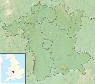
Worcestershire and Ripple Field
The Battle of Ripple Field, fought on 13 April 1643, was an engagement in the
Sir William Waller
.
Prelude
After marching north from
Upton-Upon-Severn and quickly proceeded south through Ryall to confront Waller's men who had taken a defensive position in Ripple Field.[5]
Battle
An initial cavalry charge by Waller was easily repelled by the Royalists. The Parliamentarians then retreated into the lanes of the village of Ripple where they were overrun and routed. Haselrigge's Lobsters (one of the few proper cuirassier regiments fielded during the war) lost around 70% of their men defending the retreating Parliament army which was attempting to return to Tewkesbury. At the end, Parliamentary reinforcements checked the Royalists at Mythe Hill just north of Tewkesbury.[6]
Citations
- ^ Willis-Bund 1905, p. 81.
- ^ a b Plant 10 August 2009).
- ^ Willis-Bund 1905, p. 83.
- ^ Willis-Bund 1905, p. 83.
- ^ Willis-Bund 1905, pp. 81–82.
- ^ Willis-Bund 1905, pp. 82–83.
References
- Plant, David (10 August 2009). "Ripple Field, April 1643". BCW Project. David Plant. Retrieved 2 August 2020.
- Willis-Bund, John William (1905). The Civil War in Worcestershire, 1642-1646: And the Scotch Invasion of 1651. Birmingham: The Midland Education Company.

