
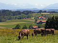
Betzigau
Betzigau | |
|---|---|
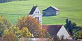
_01.JPG) Saint Afra Church | |
 Coat of arms | |
Location of Betzigau within Oberallgäu district 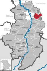 | |
Oberallgäu | |
| Government | |
| • Mayor (2020–26) | Roland Helfrich[1] |
| Area | |
| • Total | 29.27 km2 (11.30 sq mi) |
| Elevation | 728 m (2,388 ft) |
| Population (2022-12-31)[2] | |
| • Total | 2,989 |
| • Density | 100/km2 (260/sq mi) |
| Time zone | UTC+01:00 (CET) |
| • Summer (DST) | UTC+02:00 (CEST) |
| Postal codes | 87488 |
| Dialling codes | 0831 |
| Vehicle registration | OA |
| Website | www.betzigau.de |
Betzigau (German pronunciation: [Betzigau] ⓘ)is a municipality in the district of Oberallgäu in Bavaria in Germany. The altitude of the village ranges from 709 m above sea level to 946 m. Betzigau is on the Buchloe–Lindau railway line.
Population Development
From 1988 to 2008 Betzigau grew by 440 residents, or 19 %. Between 1988 and 2018 the village grew from 2320 to 2926 so 606 residents, or 26,1 %.
The following figures refer to the territorial status of May 25, 1987.
| Population Development | ||||||||||||||
|---|---|---|---|---|---|---|---|---|---|---|---|---|---|---|
| Year | 1840 | 1900 | 1939 | 1950 | 1961 | 1970 | 1987 | 1991 | 1995 | 2000 | 2005 | 2010 | 2015 | |
| Residents | 1092 | 1265 | 1319 | 1747 | 1648 | 1803 | 2280 | 2499 | 2637 | 2775 | 2830 | 2747 | 2845 | |
Politic
Roland Helfrich is the mayor of Betzigau.
The municipal tax revenue in 2017 was €2,841,000. Of that, €606,000 were revenue from trade tax.
Ground Monuments
-
 Betzigau
 -
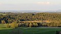
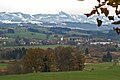 Betzigau from the northwest
 -
 Hauptmannsgreut
 -
 Hochgreut (920 m)
 -
 High shoulder (941 m)
 -
 Kaisersmad
 -
 Leiterberg 70
 -
 Notzenweiher
 -
 Ruine Schönberg
 -
 Stein
Stein -
 Unterhalden


References
- Bayerisches Landesamt für Statistik, 15 July 2021.
- ^ Genesis Online-Datenbank des Bayerischen Landesamtes für Statistik Tabelle 12411-003r Fortschreibung des Bevölkerungsstandes: Gemeinden, Stichtag (Einwohnerzahlen auf Grundlage des Zensus 2011) (Hilfe dazu).
| International | |
|---|---|
| National | |
This Oberallgäu location article is a stub. You can help Wikipedia by expanding it. |