
Bingöl Province
Bingöl Province
Bingöl ili | |
|---|---|
 Location of the province within Turkey | |
| Country | Turkey |
| Seat | Bingöl |
| Government | |
| • Governor | Ahmet Hamdi Usta |
| Area | 8,003 km2 (3,090 sq mi) |
| Population (2022)[1] | 282,556 |
| • Density | 35/km2 (91/sq mi) |
| Time zone | UTC+3 (TRT) |
| Area code | 0426 |
| Website | www |
Bingöl Province (
The town of Genç was the scene of origin for the Kurdish Sheikh Said rebellion in 1925 and most of the region was captured by the rebels during the rebellion.[8]
As the current
Geography
The largest lake in Bingöl Province is Lake Bahri.[10] The main mountains in Bingöl province are the Genç Mountains, Akçara Mountains, Şerafettin Mountains and Bingöl Mountains.[11]
Demographics
| Year | Pop. | ±% p.a. |
|---|---|---|
| 1940 | 70,184 | — |
| 1950 | 97,328 | +3.32% |
| 1960 | 131,364 | +3.04% |
| 1970 | 177,951 | +3.08% |
| 1980 | 228,702 | +2.54% |
| 1990 | 250,966 | +0.93% |
| 2000 | 253,739 | +0.11% |
| 2010 | 255,170 | +0.06% |
| 2020 | 281,768 | +1.00% |
| Source:Turkstat[12][13][14] | ||
Kurds comprise the majority of the province and the province is considered part of Turkish Kurdistan.[15][16] Its population is majority Sunni, conservative and many adhere to the Naqshbandi order.[17][18] The province moreover has a significant Alevi minority.[19] Linguistically, the southern parts of the province speak Zaza, while the northern parts speak Kurmanji. Many Zaza-speakers speak Kurmanji as well.[20]
Language and religion statistics
Bingöl Province was part of
In the 1906-1907 census, the sanjak had a population of 45,215 of which 86.8% was Muslim and Armenians comprised the remaining 13.2%. In the last Ottoman census in 1914, the region had a population of 38,096 of which 93.9% was Muslim and 6.1% Armenian.[22]
The first Turkish census which included Bingöl Province was the 1945 census, where the population was 75,550 who all were Muslims. Linguistically, the most spoken
A 2016 survey showed that 90.4% of the population spoke Turkish, 64.1% spoke Zaza, 40.1% spoke Kurmanji and 5.6% spoke
History
From 1923 to 1929, Bingöl Province was part of Elazığ Province and part of Muş Province from 1929 to 1936. It ultimately became a province in 1936.[5]
In December 1935 the Tunceli Law was passed which demanded a more powerful government in the region.
Districts

Bingöl province is divided into 8 districts (capital district in bold):
Gallery
-
-
 Haserek ski facilities
 -
 Bingöl center
 -
 Piltan (Balaban Bey) Mosque
 -
 Sülbüs Mountain
 -
 Gülbahar Barrage
 -
 Buban Fairy Chimneys in the village of Oğuldere
 -

-
 Çır waterfall, also known as Çır Şelalesi
 -
 33 Martyrs Memorial
 -
 Bingöl Airport
 -
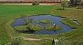
 Gerendal Lake


Bibliography
- Dündar, Fuat (2000), Türkiye nüfus sayımlarında azınlıklar (in Turkish), ISBN 9789758086771
References
- ^ TÜİK. Retrieved 19 September 2023.
- ^ "Li 26 herêmên Çewlîgê "herêmên ewlehiya taybet" hat ragihandin". Rûdaw. 11 November 2018. Retrieved 27 April 2020.
- ^ Lezgîn, Roşan (26 August 2009). "Kirmanckî, Kirdkî, Dimilkî, Zazakî" (in Zazaki). Retrieved 22 November 2022.
- ^ a b "Türkiye Mülki İdare Bölümleri Envanteri". T.C. İçişleri Bakanlığı (in Turkish). Retrieved 19 December 2022.
- ^ a b "Valilik Tarihçesi". www.bingol.gov.tr. Retrieved 2020-04-12.
- ^ "İl ve İlçe Yüz ölçümleri". General Directorate of Mapping. Retrieved 19 September 2023.
- TÜİK. Retrieved 30 January 2023.
- ISBN 9780874809046.
- ^ "Valimiz". Bingöl Valiliği. Retrieved 21 October 2023.
- ^ "Bingöl araştırmaları dergisi" (PDF) (in Turkish). The journal of Bingöl studies. Bingöl University. July 9, 2015. p. 89.
- ^ "Bingöl İli Memeli Biyoçeşitliliği ve Ekolojisi" (PDF) (in Turkish). Batman University Fen Bilimleri Enstitüsü. p. 18.
- ^ Genel Nüfus Sayımları
- ^ Turkstat
- ^ "The Results of Address Based Population Registration System, 2020". Turkish Statistical Institute. Archived from the original on 2021-10-28. Retrieved 7 December 2021.
- ISBN 978-0-295-99050-7.
- ISBN 9789004161214.
- ^ "Turkish Town's Despair Breeds Terrorists, Residents Fear". The New York Times. 27 November 2003. Retrieved 7 January 2021.
- ^ Ayiş, Mehmet Şirin (2018). "Bingöl ve Çevresinde Halidîliğin Yayılmasında Etkili Olmuş Sufi Şahsiyetler" (PDF). BÜİFD. 11. University of Bingöl: 183–208.
- ISBN 9789004314825.
- ISBN 9780195051964.
- ISBN 9780299091606.
- ISBN 9780299091606.
- ^ Dündar (2000), pp. 176–178.
- ^ Dündar (2000), p. 186.
- ^ Dündar (2000), p. 218.
- ISBN 978-605-8295-10-0.
- ISBN 978-1-134-17448-5.
- ^ ISBN 978-1-317-09579-8.
- ISBN 978-1-134-17448-5.
- ISBN 978-0-521-62096-3.