
Bowdoinham, Maine
Bowdoinham, Maine | ||
|---|---|---|
FIPS code 23-06365 | | |
| GNIS feature ID | 0582361 | |
| Website | Town of Bowdoinham, Maine | |
Bowdoinham is a
History
Fort Richmond was built upriver in 1719, protecting the area and encouraging British settlement. About 1720, the mouth of the Cathance River was first settled by Captain Gyles Watkins. But during Dummer's War, in the summer of 1723 all buildings in the region were burned and cattle killed by the Norridgewocks and their 250 Indian allies from New France. The Kennebec River region was abandoned. When Gov. William Dummer's Treaty of 1725 brought peace, it was resettled about 1730 by Abraham and Jonas Preble from York.[3]
Litigation from two conflicting claims, however, slowed the town's development. On July 3, 1637,
Geography
According to the United States Census Bureau, the town has a total area of 39.20 square miles (101.53 km2), of which 34.40 square miles (89.10 km2) is land and 4.80 square miles (12.43 km2) is water.[7] Situated beside Merrymeeting Bay, Bowdoinham is drained by the Cathance River, Abagadasset River, Muddy River and Kennebec River.
The town is crossed by Interstate 295 and state routes 24, 125 and 138. It borders the towns of Richmond to the north, Bowdoin to the west, and Topsham to the south.
Demographics
| Census | Pop. | Note | %± |
|---|---|---|---|
| 1790 | 455 | — | |
| 1800 | 792 | 74.1% | |
| 1810 | 1,412 | 78.3% | |
| 1820 | 2,259 | 60.0% | |
| 1830 | 2,061 | −8.8% | |
| 1840 | 2,402 | 16.5% | |
| 1850 | 2,382 | −0.8% | |
| 1860 | 2,343 | −1.6% | |
| 1870 | 1,804 | −23.0% | |
| 1880 | 1,681 | −6.8% | |
| 1890 | 1,508 | −10.3% | |
| 1900 | 1,305 | −13.5% | |
| 1910 | 1,385 | 6.1% | |
| 1920 | 1,030 | −25.6% | |
| 1930 | 904 | −12.2% | |
| 1940 | 915 | 1.2% | |
| 1950 | 1,039 | 13.6% | |
| 1960 | 1,131 | 8.9% | |
| 1970 | 1,294 | 14.4% | |
| 1980 | 1,828 | 41.3% | |
| 1990 | 2,192 | 19.9% | |
| 2000 | 2,612 | 19.2% | |
| 2010 | 2,889 | 10.6% | |
| 2020 | 3,047 | 5.5% | |
| U.S. Decennial Census[8] | |||
2010 census
As of the
There were 1,179 households, of which 31.6% had children under the age of 18 living with them, 56.3% were married couples living together, 9.9% had a female householder with no husband present, 5.3% had a male householder with no wife present, and 28.4% were non-families. 20.3% of all households were made up of individuals, and 7.3% had someone living alone who was 65 years of age or older. The average household size was 2.45 and the average family size was 2.80.
The median age in the town was 43.7 years. 21.6% of residents were under the age of 18; 5.9% were between the ages of 18 and 24; 24.6% were from 25 to 44; 35.2% were from 45 to 64; and 12.7% were 65 years of age or older. The gender makeup of the town was 50.1% male and 49.9% female.
As of the updated
2000 census
As of the
There were 1,027 households, out of which 35.1% had children under the age of 18 living with them, 58.0% were married couples living together, 9.4% had a female householder with no husband present, and 26.7% were non-families. 20.1% of all households were made up of individuals, and 5.6% had someone living alone who was 65 years of age or older. The average household size was 2.54 and the average family size was 2.90.
In the town, the population was spread out, with 25.8% under the age of 18, 5.9% from 18 to 24, 30.1% from 25 to 44, 28.1% from 45 to 64, and 10.1% who were 65 years of age or older. The median age was 39 years. For every 100 females, there were 99.5 males. For every 100 females age 18 and over, there were 98.9 males.
Education
Public schools in the area are operated by Maine School Administrative District 75.
Sites of interest
- Bowdoinham Wildlife Management Area
- Merrymeeting Bay
- The Sands
- Mailly Waterfront Park
Notable people
- Carroll W. Blake, motion picture exhibitor and real estate investor
- Sally Cluchey, state legislator
- Gardner Colby, businessman, philanthropist, namesake of Colby College
- Robert Browne Hall, composer of marching music
- Orrington Lunt, businessman
- Arthur B. Patten, clergyman and author
- Frank Sandford, religious leader
- Pop Williams, baseball pitcher
References
- ^ "Town of Bowdoinham, Maine". Town of Bowdoinham, Maine. Retrieved August 26, 2012.
- ^ "Census - Geography Profile: Bowdoinham town, Sagadahoc County, Maine". Retrieved January 16, 2022.
- ^ Coolidge, Austin J.; John B. Mansfield (1859). A History and Description of New England. Boston, Massachusetts: A.J. Coolidge. pp. 60–61.
coolidge mansfield history description new england 1859.
- ^ History of Bowdoinham, Maine Archived June 26, 2007, at the Wayback Machine
- ^ Brief Description and History of Bowdoinham, Maine
- ^ Varney, George J. (1886), Gazetteer of the state of Maine. Bowdoinham, Boston: Russell
- ^ "US Gazetteer files 2010". United States Census Bureau. Retrieved December 16, 2012.
- ^ "Census of Population and Housing". Census.gov. Retrieved June 4, 2015.
- ^ "U.S. Census website". United States Census Bureau. Retrieved December 16, 2012.
- ^ "U.S. Census website". United States Census Bureau. Retrieved January 31, 2008.
External links
Municipalities and communities of Sagadahoc County, Maine, United States | ||
|---|---|---|
| City | 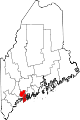 | |
| Towns | ||
| Unorganized territory | ||
| CDPs | ||
| Other villages | ||
| ||
| International | |
|---|---|
| National | |