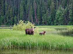
Bowron River
| Bowron River | |
|---|---|
 | |
| Location | |
| Country | Canada |
| Province | British Columbia |
| District | Cariboo Land District |
| Physical characteristics | |
| Mouth | Fraser River |
• coordinates | 54°3′30″N 121°49′35″W / 54.05833°N 121.82639°W[1] |
• elevation | 589 m (1,932 ft)[2] |
| Discharge | |
| • location | gage 08KD007[3] |
| • average | 64.7 m3/s (2,280 cu ft/s)[3] |
| • minimum | 8.85 m3/s (313 cu ft/s) |
| • maximum | 580 m3/s (20,000 cu ft/s) |
The Bowron River, also formerly named the Bear River and Reid Creek,Barkerville.
Notable features
Portage Canyon, accessed by a 0.5 km trail off the Vama Vama Forest Service Road, is a stretch of rough water in the lower third of the Bowron River. This spot provides a secluded picnic spot and prime trout-fishing.
See also
References
- ^ a b "Bowron River". BC Geographical Names.
- ASTER Global Digital Elevation Model, using GeoLocator, and BCGNIS source coordinates.
- ^ a b "Archived Hydrometric Data Search". Water Survey of Canada. Archived from the original on 24 December 2010. Retrieved 4 August 2013. Search for Station 08KD007 Bowron River below Box Canyon
