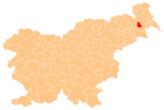
Bučečovci
Bučečovci | |
|---|---|
Styria | |
| Statistical region | Mura |
| Municipality | Križevci |
| Area | |
| • Total | 4.39 km2 (1.69 sq mi) |
| Elevation | 191.5 m (628.3 ft) |
| Population (2002) | |
| • Total | 268 |
| [1] | |
Bučečovci (pronounced Styria. It is now included with the rest of the municipality in the Mura Statistical Region.[3]
A small Neo-Gothic chapel in the settlement was built in 1890.[4]
References
- ^ Statistical Office of the Republic of Slovenia
- ^ Leksikon občin kraljestev in dežel zastopanih v državnem zboru, vol. 4: Štajersko. Vienna: C. Kr. Dvorna in Državna Tiskarna. 1904. p. 182.
- ^ Križevci municipal site Archived September 24, 2008, at the Wayback Machine
- ^ Slovenian Ministry of Culture register of national heritage reference number ešd 23058
External links

