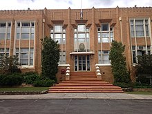
Canterbury, Victoria
| Canterbury Federal division(s) | Kooyong | ||||||||||||||
|---|---|---|---|---|---|---|---|---|---|---|---|---|---|---|---|
| |||||||||||||||
Canterbury is an eastern suburb of
Famed for its leafy green boulevards and substantial, opulent historic residences, Canterbury is one of Melbourne's most expensive and exclusive suburbs.
Geography
Canterbury extends as far as Mont Albert Road in the north,
Canterbury is the home to many of Victoria's oldest and most prestigious private schools, including Camberwell Grammar School, Camberwell Girls Grammar School and Strathcona Baptist Girls Grammar School. Other schools include Camberwell High School, Canterbury Girls' Secondary College and Canterbury Primary School. Canterbury contains various parks and gardens and is home to the Camberwell Hockey Club in Matlock Street. The Canterbury Sports Ground, home of cricket and Australian football, is in Chatham Road.
The main shopping area in Canterbury is around the
Canterbury is serviced by the
.History
The railway station is in many ways responsible for the suburb's existence: before the opening of the railway to the City in 1882, the area was a semi-rural area. Even then, it was occupied by the well to do. Many of these early residents and in some cases, their properties, are remembered in the street names of the suburb, notably Logan Street and Monomeath Avenue.

Canterbury Post Office opened on 22 November 1870 (it was closed between 1887 and 1892).[2] It has since been turned into a café.
The first subdivision in the area came in 1885, when Michael Logan created the 'Claremont Park Estate' within the area of Canterbury Road, Bryson Street, Prospect Hill Road and Logan Street.
At around this time, Edward Snowden settled on 7 hectares in the area centred on a manor he named Monomeath. In 1900 Snowden's estate was subdivided and sold off to form what is now Monomeath Avenue and residents such as notable architect Percey Kernot and prominent citizen George Coghill moved in. The road was paved in 1911 and lined with
Population
In the 2016 Census, there were 8,056 people in Canterbury. 67.2% of people were born in Australia. The next most common countries of birth were China 7.9%, England 3.7%, Malaysia 1.7%, New Zealand 1.6% and India 1.3%. 73.4% of people spoke only English at home. Other languages spoken at home included Mandarin 9.9%, Cantonese 2.4% and Italian 1.3%. The most common responses for religion were No Religion 37.7%, Catholic 20.1% and Anglican 12.8%.[4]
Culture


Canterbury is regarded as one of Melbourne's most exclusive suburbs, particularly the "Golden Mile" – a term referring to a part of Mont Albert Road, running west from Balwyn Road and the avenues that connect it to Canterbury Road, specifically Monomeath Avenue, which is lined by large, century old oak trees and grand ornate mansions and is home to many notable politicians and leaders of business and industry.[5]
Other blue-chip locales along this stretch include Alexandra Avenue, Hopetoun Avenue, Victoria Avenue and The Ridge. It consistently ranks in the top three suburbs for average house prices in Melbourne.

Notable residents
Present and past residents of Canterbury include or have included:
- FRSNZ – virologist best known for his contributions to immunology. He won a Nobel Prize in 1960 for predicting acquired immune tolerance and was best known for developing the theory of clonal selection. He was the first ever Australian of the Year and the Burnet Institute is named in his honour[5]
- Frank Cheshire, bookseller and publisher who founded the F. W. Cheshire Pty. Ltd. publishing house[6]
- Frank Cicutto – former CEO of National Australia Bank[5]
- Sir Rupert Hamer – former Premier of Victoria[5]
- Billy Harvey MC, Australian Rules footballer[7] who during World War I won the Military Cross[8] and was killed during the Battle of Passchendaele
- Kylie and Dannii Minogue's family[citation needed]
- Andrew Peacock – former federal leader of the Liberal Party of Australia[5]
- Tom Schieffer – former US Ambassador to Australia, and to Japan[citation needed]
Sport
The suburb has an Australian rules football team called the Canterbury Cobras, who compete in the Yarra Junior Football League.
Schools

Canterbury has a number of primary and secondary schools in its vicinity. These include Canterbury Primary School,
Places of worship
See also
- City of Camberwell – Canterbury was previously within this former local government area.
References
- ^ Australian Bureau of Statistics (28 June 2022). "Canterbury (Vic.) (Suburbs and Localities)". 2021 Census QuickStats. Retrieved 3 July 2022.
 Material was copied from this source, which is available under a Creative Commons Attribution 4.0 International License.
- ^ Premier Postal History, Post Office List, retrieved 11 April 2008
- ^ Aussie Heritage. "Monomeath Avenue Streetscape, Canterbury, VIC". Archived from the original on 19 May 2007. Retrieved 5 May 2007.
- ^ Australian Bureau of Statistics (27 June 2017). "Canterbury (State Suburb)". 2016 Census QuickStats. Retrieved 14 October 2018.
 Material was copied from this source, which is available under a Creative Commons Attribution 4.0 International License.
- ^ a b c d e Katherine Townsend, "Melbourne's Monomeath Avenue used to be the understated home of the city's A-listers", domain.com.au. Retrieved 14 November 2022.
- ^ John Arnold, Cheshire, Frank Walter (1896–1987), Australian Dictionary of Biography, anu.edu.au. Retrieved 14 November 2022.
- ^ William George HARVEY MC, vwma.org.au. Retrieved 14 November 2022.
- ^ Honours and Awards: William George Harvey, awm.gov.au. Retrieved 14 November 2022.
- ^ "Home". canterburyecclesia.org.au.
- ^ "Home". canterburypc.org.au.
- ^ "Home". canterburybaptist.org.
