
Canyon Lake (Arizona)
| Canyon Lake | ||
|---|---|---|
Primary inflows Salt River | | |
| Primary outflows | Salt River | |
| Basin countries | United States | |
| Surface area | 950 acres (380 ha) | |
| Average depth | 130 ft (40 m) | |
| Surface elevation | 1,660 ft (510 m) | |
Canyon Lake is one of four
Saguaro Lake
, is downstream.
Canyon Lake lies approximately 15 miles (24 km) up the
Superstition Wilderness of Tonto National Forest and is a popular recreation area for the Phoenix metropolitan area. Recreation amenities include hiking trails, camping, and boating, all managed by the United States Forest Service. Canyon Lake is a popular stop along the Apache Trail (Arizona State Route 88) from Apache Junction, Arizona, passing Tortilla Flat, Arizona, before reaching Apache Lake and Roosevelt Lake behind Theodore Roosevelt Dam
.
In 2022, a fish kill caused by golden algae affected 100,000 fish. [1]
Fish species
- Rainbow Trout
- Largemouth Bass
- Smallmouth Bass
- Yellow Bass
- Crappie
- Sunfish
- Catfish (Channel)
- Walleye
- Carp
Gallery

-
 The Dolly Steamboat
 -
 The lake at dusk...
 -
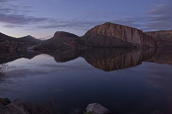 ...and just after sunset.
.jpg)

.jpg)
References
- ^ "Golden alga-caused fish kills confirmed at Saguaro, Canyon and Apache lakes". Archived from the original on 2022-08-19. Retrieved 2022-08-19.
- Information and Education Division (2007). "Arizona Fishin' Holes". Phoenix, AZ: Arizona Game and Fish Department.
{{cite journal}}: Cite journal requires|journal=(help)
External links
Wikimedia Commons has media related to Canyon Lake (Arizona).
- U.S. Geological Survey Geographic Names Information System: Canyon Lake
- Canyon Lake Marina Website
- Daily Water Level report from SRP
- Arizona Boating Locations Facilities Map
- Arizona Fishing Locations Map
- Video of Canyon Lake, Arizona
| Lakes/ponds | |
|---|---|
| Reservoirs | |
| International | |
|---|---|
| National | |
| Other | |