
Casnovia, Michigan
Casnovia, Michigan | ||
|---|---|---|
FIPS code 26-13820[3] | | |
| GNIS feature ID | 0622844[4] | |
| Website | https://villageofcasnovia.org/ | |
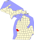
Casnovia is a village in the U.S. state of Michigan. It is situated on the boundary between Muskegon and Kent counties and lies partially within each. The population was 316 at the 2020 census.[2]
History
Casnovia was founded in 1850 by Lot Fulkerson and gained a post office in 1851. It was platted in 1862 and incorporated as a village in 1875. The name is derived from the Latin words case for home and nova for new.[5]
Geography
The village is in western Michigan, in the eastern part of Muskegon County and the northwest part of Kent County. The village is in eastern
According to the
Demographics
| Census | Pop. | Note | %± |
|---|---|---|---|
| 1880 | 196 | — | |
| 1890 | 275 | 40.3% | |
| 1900 | 277 | 0.7% | |
| 1910 | 308 | 11.2% | |
| 1920 | 333 | 8.1% | |
| 1930 | 254 | −23.7% | |
| 1940 | 289 | 13.8% | |
| 1950 | 312 | 8.0% | |
| 1960 | 371 | 18.9% | |
| 1970 | 403 | 8.6% | |
| 1980 | 348 | −13.6% | |
| 1990 | 376 | 8.0% | |
| 2000 | 315 | −16.2% | |
| 2010 | 319 | 1.3% | |
| 2020 | 316 | −0.9% | |
| U.S. Decennial Census[6] | |||
2020 census
As of the
2010 census
As of the
There were 121 households, of which 28.1% had children under the age of 18 living with them, 65.3% were married couples living together, 7.4% had a female householder with no husband present, 5.0% had a male householder with no wife present, and 22.3% were non-families. 15.7% of all households were made up of individuals, and 3.3% had someone living alone who was 65 years of age or older. The average household size was 2.64 and the average family size was 2.97.
The median age in the village was 41.9 years. 22.3% of residents were under the age of 18; 8.6% were between the ages of 18 and 24; 23.8% were from 25 to 44; 32.3% were from 45 to 64; and 12.9% were 65 years of age or older. The gender makeup of the village was 50.8% male and 49.2% female.
2000 census
As of the
There were 122 households, out of which 33.6% had children under the age of 18 living with them, 60.7% were married couples living together, 8.2% had a female householder with no husband present, and 25.4% were non-families. 19.7% of all households were made up of individuals, and 8.2% had someone living alone who was 65 years of age or older. The average household size was 2.58 and the average family size was 2.98.
In the village, the population was spread out, with 25.4% under the age of 18, 8.6% from 18 to 24, 33.3% from 25 to 44, 21.9% from 45 to 64, and 10.8% who were 65 years of age or older. The median age was 35 years. For every 100 females, there were 107.2 males. For every 100 females age 18 and over, there were 99.2 males.
The median income for a household in the village was $42,019, and the median income for a family was $47,188. Males had a median income of $36,563 versus $26,250 for females. The
Notable people
- Bion J. Arnold, electrical engineer; born in Casnovia
- Floyd R. Newman (1890–1990), oil man
References
Notes
- ^ a b "2023 U.S. Gazetteer Files: Michigan". United States Census Bureau. Retrieved December 18, 2023.
- ^ a b "P1. Race – Casnovia village, Michigan: 2020 DEC Redistricting Data (PL 94-171)". U.S. Census Bureau. Retrieved December 18, 2023.
- ^ a b "U.S. Census website". United States Census Bureau. Retrieved January 31, 2008.
- ^ "US Board on Geographic Names". United States Geological Survey. October 25, 2007. Retrieved January 31, 2008.
- ^ Romig 1986, p. 102.
- ^ "Census of Population and Housing". Census.gov. Retrieved June 4, 2015.
- ^ "Zip Atlas website". Zip Atlas. Retrieved May 9, 2024.
- ^ "U.S. Census website". United States Census Bureau. Retrieved November 25, 2012.
Sources
- Romig, Walter (October 1, 1986) [1973]. Michigan Place Names: The History of the Founding and the Naming of More Than Five Thousand Past and Present Michigan Communities (Paperback). Great Lakes Books Series. Detroit, Michigan: ISBN 0-8143-1838-X.
Municipalities and communities of Kent County, Michigan, United States | ||
|---|---|---|
| Cities |  | |
| Villages | ||
| Charter townships | ||
| Civil townships | ||
| CDPs | ||
| Other communities | ||
| Footnotes | ‡This populated place also has portions in an adjacent county or counties | |
| ||
 | ||||
Villages | ||||
| Charter townships | ||||
| General law townships | ||||
| CDPs | ||||
| Other communities |
| |||
| Footnotes | ‡This populated place also has portions in an adjacent county or counties | |||
| ||||