
Cayo Santiago
 | |
 Cayo Santiago  Cayo Santiago  Cayo Santiago | |
| Geography | |
|---|---|
| Location | Humacao, Puerto Rico |
| Coordinates | 18°9′23″N 65°44′3″W / 18.15639°N 65.73417°W |
| Area | 0.139179 km2 (0.053737 sq mi) |
| Length | 0.6 km (0.37 mi) |
| Width | 0.4 km (0.25 mi) |
| Highest elevation | 34.9 m (114.5 ft) |
| Highest point | El Morrillo or "Big Cay hill top" |
| Administration | |
| Commonwealth | Puerto Rico |
| Municipality | Humacao |
Cayo Santiago, also known as Santiago Island, Isla de los monos (or Island of the monkeys), is located at 18°09′23″N 65°44′03″W / 18.15639°N 65.73417°W, 0.59 mi (0.95 km) 0.6 mi (1.0 km) to the east of Punta Santiago, Humacao, Puerto Rico.[1][2]
Geography
The island measures approximately 37.5 acres (15.2 ha), or 660 yards (600 m), north–south and 440 yards (400 m) east–west, including a "Small Key" which is connected to the main area ("Big Key") by a narrow, sandy isthmus. Six-hundred meters west of the southernmost point is a shoal, Bajo Evelyn, which has a shallow depth of 8 fathoms. While the island is flat to the north, it reaches a height of 114.5 ft (34.9 m), 1.8 mi (2.9 km) southwest of the island's port, on a small, rocky hill called El Morrillo, rising abruptly from the water and the surrounding lowlands. The area of the island is 0.054 sq mi (0.14 km2): Block 2000, Census Block Group 2, Census tract 1801, Humacao Municipio, Puerto Rico), of which the northeastern peninsula accounts for about 0.01 sq mi (0.03 km2).[3]
In the late 1940s, the island was expropriated by Puerto Rico from its private owners and ceded to the University of Puerto Rico. Only designated personnel and researchers are allowed on the island, although tourists can charter a boat to circle the island and view its primate inhabitants.[4]
Resident Taxa
Since December 1938, the island has been home to a free-ranging population of
Cayo Batata, a small island located 4 mi (6 km) to the southwest of Cayo Santiago, is under the jurisdiction of Humacao, and is also uninhabited by humans.
Gallery
-
 Nautical Chart of Cayo Santiago area
 -
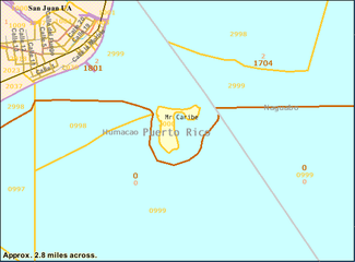 Census Bureau Map


-
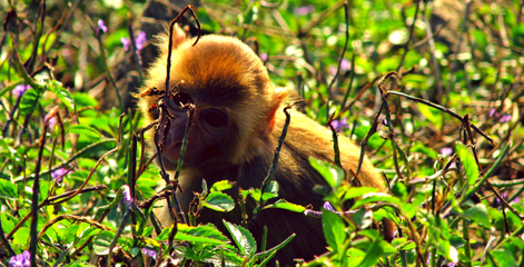 Shy monkey at Cayo Santiago, Puerto Rico
 -
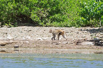 A monkey walks on the beach of Cayo Santiago


References
- ^ PMID 25764995.
- ^ Congress, The Library of. "LC Linked Data Service: Authorities and Vocabularies (Library of Congress)". id.loc.gov. Retrieved 2021-03-26.
- ^ "Puerto Rico and Virgin Islands NOAA Chart 25640" (PDF). NOAA. NOAA. Retrieved 29 October 2020.
- ^ "Monkey Island". Atlas Obscura. Retrieved 15 June 2019.
- )
External links
- Cayo Santiago & The Origins NIH NPRC Program with Hurricane Maria of 9/20/2017 update
- Video about the monkeys on Cayo Santiago
- Caribbean Primate Research Center
- University of Puerto Rico page
- Primate Research Center
| International | |
|---|---|
| National | |