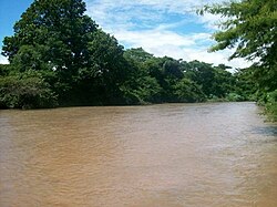
Cesar River
Appearance
| Cesar River | |
|---|---|
 | |
 The Cesar River basin, Cesar Department in color | |
| Location | |
| Country | Colombia |
| Department | Cesar Department |
| Physical characteristics | |
| Source | |
| • location | Colombia |
| Mouth | |
• location | Magdalena River |
• coordinates | 8°59′46″N 73°58′04″W / 8.9961°N 73.9678°W |
| Length | 280 kilometres (170 mi) [1] |
| Basin size | 9,832 square kilometres (3,796 sq mi) |
| Basin features | |
| Cities | Valledupar |
The Cesar River (
Zapatosa Marsh where it turns to the southwest and discharges into the Magdalena River after 280 kilometers.[2][1] Valledupar
is the only major city on its route.
Tributaries
- Guatapuri River[3]
- Ariguani River[3]
- Badillo River[3]
- Villanueva River, 43 kilometres (27 mi) in length out of the Cerro Pintao.[4]
- Various streams of the Zapatosa Marshes including the
- Bartolazo wetlands;
- Pancuiche wetlands;
- Pancuichito wetlands;
- La Palma wetlands;
- Santo Domingo wetlands; and
- Tiojuancho wetlands.
References
- ^ ISBN 978-958-8281-70-4.
- ^ Index Geografia Hidrografia (Colombian Hydrographic Index) Archived November 8, 2006, at the Wayback Machine in Spanish
- ^ a b c Bealey, J. T. (1887) "Sierra Nevada de Santa Marta" Scottish Geographical Magazine 3: pp. 174-184, page 180
- ^ "Municipio Villanueva - Geografia (Villanueva Municipality - Geography)"[permanent dead link] (in Spanish), accessed 8 December 2008
Further reading
- Striffler, Luis (1989) El Río César: Relación de un viaje a la Sierra Nevada de Santa Marta en 1876 Senado de la República, Bogotá, OCLC 23356826
