
Chatfield, Minnesota
Chatfield | ||
|---|---|---|
FIPS code 27-11008[3] | | |
| GNIS feature ID | 2393810[2] | |
| Website | www | |
Chatfield is a city in
History
The city was named after Judge
Geography


According to the United States Census Bureau, the city has a total area of 2.64 square miles (6.84 km2).[9] It is also the home of the only stop light in Fillmore County, at the intersection of 3rd Street (Fillmore County Road 2) and Main Street. Chatfield has two waterways within its borders, the North Branch of the Root River and a tributary, Mill Creek.[10]
U.S. Highway 52, State Highway 30, State Highway 74, and Fillmore County Road 2 are four of the main routes in the city.

The North Branch of the Root River flows nearby, and Mill Creek runs through the town. Mill Creek is a designated trout stream.[11]
Demographics
| Census | Pop. | Note | %± |
|---|---|---|---|
| 1880 | 9,001 | — | |
| 1890 | 1,335 | −85.2% | |
| 1900 | 1,426 | 6.8% | |
| 1910 | 1,228 | −13.9% | |
| 1920 | 1,382 | 12.5% | |
| 1930 | 1,269 | −8.2% | |
| 1940 | 1,640 | 29.2% | |
| 1950 | 1,605 | −2.1% | |
| 1960 | 1,841 | 14.7% | |
| 1970 | 1,885 | 2.4% | |
| 1980 | 2,055 | 9.0% | |
| 1990 | 2,226 | 8.3% | |
| 2000 | 2,394 | 7.5% | |
| 2010 | 2,779 | 16.1% | |
| 2020 | 2,997 | 7.8% | |
| U.S. Decennial Census[12] | |||
2010 census
As of the
There were 1,092 households, of which 38.6% had children under the age of 18 living with them, 52.9% were married couples living together, 11.1% had a female householder with no husband present, 3.8% had a male householder with no wife present, and 32.1% were non-families. 26.9% of all households were made up of individuals, and 14.1% had someone living alone who was 65 years of age or older. The average household size was 2.48 and the average family size was 3.03.
The median age in the city was 36.9 years. 28.6% of residents were under the age of 18; 5.7% were between the ages of 18 and 24; 26.6% were from 25 to 44; 22% were from 45 to 64; and 16.9% were 65 years of age or older. The gender makeup of the city was 46.7% male and 53.3% female.
2000 census
As of the
There were 930 households, out of which 35.5% had children under the age of 18 living with them, 56.3% were married couples living together, 9.0% had a female householder with no husband present, and 31.9% were non-families. 27.4% of all households were made up of individuals, and 14.7% had someone living alone who was 65 years of age or older. The average household size was 2.46 and the average family size was 3.00.
In the city, the population was spread out, with 26.0% under the age of 18, 7.4% from 18 to 24, 28.7% from 25 to 44, 17.2% from 45 to 64, and 20.7% who were 65 years of age or older. The median age was 37 years. For every 100 females, there were 88.5 males. For every 100 females age 18 and over, there were 84.6 males.
The median income for a household in the city was $44,023, and the median income for a family was $53,625. Males had a median income of $32,174 versus $27,697 for females. The
Education

Entertainment
On the second weekend of August, the town holds its annual "Western Days".[14]
The Chatfield Brass Band Music Lending Library[15] is a world-class sheet music library dedicated to the preservation and use of sheet music from the brass band era.[16]
The Chatfield Center for the Arts presents live music, visual arts and theater.[17] The Potter Auditorium was renovated in 2016.[18]
The Pope & Young Museum of Bowhunting opened in Chatfield in 2004.[19]
References
- ^ "2020 U.S. Gazetteer Files". United States Census Bureau. Retrieved July 24, 2022.
- ^ a b U.S. Geological Survey Geographic Names Information System: Chatfield, Minnesota
- ^ a b "U.S. Census website". United States Census Bureau. Retrieved January 31, 2008.
- ^ "2010 Census Redistricting Data (Public Law 94-171) Summary File". American FactFinder. United States Census Bureau. Retrieved April 27, 2011.[dead link]
- ^ "Profile for Chatfield, Minnesota, MN". ePodunk. Retrieved June 30, 2012.
- ISBN 0873517121.
- ^ Minnesota: A History of the State By Theodore Christian Blegen page 202
- ^ "About Chatfield". Chatfield, Minnesota. Retrieved October 24, 2013.
- ^ "US Gazetteer files 2010". United States Census Bureau. Archived from the original on January 25, 2012. Retrieved November 13, 2012.
- ^ "Root River State Water Trail". Minnesota Department of Natural Resources. Retrieved October 24, 2013.
- ^ "Fishing Our Habitat Improvement – Mill Creek – Minnesota Trout Unlimited". Retrieved January 17, 2019.
- ^ "Census of Population and Housing". Census.gov. Retrieved June 4, 2015.
- ^ "U.S. Census website". United States Census Bureau. Retrieved November 13, 2012.
- ^ Gretchen Mensink Lovejoy (August 1, 2012). "Western Days gallops into Chatfield with full schedule of fun Aug. 9-12". Retrieved September 11, 2015.
- ^ "Chatfield Music Lending Library". Retrieved March 9, 2020.
- ^ Joe Kimball (May 1, 2008). "Pawlenty's veto of unique music library hits sour note in Chatfield". Retrieved September 11, 2015.
- ^ "Chatfield Center for the Arts". Chatfield Arts. Retrieved January 9, 2019.
- ^ Weiss, John. "'Greater than the Chatfield community'". PostBulletin.com. Retrieved January 9, 2019.
- ^ "Museum of Bowhunting". www.pope-young.org. Retrieved January 17, 2019.
External links
Municipalities and communities of Fillmore County, Minnesota, United States | ||
|---|---|---|
| Cities |  | |
| Townships | ||
| Unincorporated communities | ||
| Ghost towns | ||
| Footnotes | ‡This populated place also has portions in an adjacent county or counties | |
| ||
Municipalities and communities of Olmsted County, Minnesota, United States | ||
|---|---|---|
| Cities | 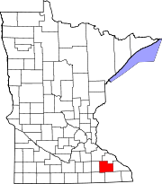 | |
| Townships | ||
| CDPs | ||
| Unincorporated communities | ||
| Footnotes | ‡This populated place also has portions in an adjacent county or counties | |
| ||
| Core city |  | |
|---|---|---|
| Incorporated Places | ||
| Counties | ||
‡ indicates that it is partially in the metropolitan area. † indicates a county seat. | ||
43°50′44″N 92°11′21″W / 43.84556°N 92.18917°W
| International | |
|---|---|
| National | |
| Other | |