
Chelles, Seine-et-Marne
You can help expand this article with text translated from the corresponding article in French. (August 2012) Click [show] for important translation instructions.
|
Chelles | |
|---|---|
 Île Refuge, in the Marne river in Chelles | |
.svg) Coat of arms | |
 Location (in red) within Paris inner and outer suburbs | |
Location of Chelles  | |
 Chelles  Chelles | |
| Coordinates: 48°53′00″N 2°36′00″E / 48.8833°N 2.6000°E | |
| Country | France |
| Region | Île-de-France |
| Department | Seine-et-Marne |
| Arrondissement | Torcy |
| Canton | Chelles |
| Intercommunality | CA Paris - Vallée de la Marne |
| Government | |
| • Mayor (2020–2026) | Brice Rabaste[1] |
| Area 1 | 16.3 km2 (6.3 sq mi) |
| Population (2021)[2] | 54,309 |
| • Density | 3,300/km2 (8,600/sq mi) |
| Time zone | UTC+01:00 (CET) |
| • Summer (DST) | UTC+02:00 (CEST) |
| INSEE/Postal code | 77108 /77500 |
| Elevation | 36–106 m (118–348 ft) |
| 1 French Land Register data, which excludes lakes, ponds, glaciers > 1 km2 (0.386 sq mi or 247 acres) and river estuaries. | |
Chelles (French pronunciation: center of Paris.
History

At the Merovingian villa of Calae the
Balthild, a seventh-century queen of the Franks. It was largely demolished at the time of the French Revolution
.
Geography
There are two main streets in Chelles, Avenue Foch and Avenue de la Résistance.
Demographics
The inhabitants are called Chellois.
|
| ||||||||||||||||||||||||||||||||||||||||||||||||||||||||||||||||||||||||||||||||||||||||||||||||||||||||||||||||||
| |||||||||||||||||||||||||||||||||||||||||||||||||||||||||||||||||||||||||||||||||||||||||||||||||||||||||||||||||||
| Source: EHESS[3] and INSEE (1968-2017)[4] | |||||||||||||||||||||||||||||||||||||||||||||||||||||||||||||||||||||||||||||||||||||||||||||||||||||||||||||||||||
Transport
Chelles is served by
Paris-Est suburban rail line 

.
Education
As of 2016[update] the commune has 13,000 students in 46 public and private schools.[5] The commune includes 19 public preschools and 16 public elementary schools.[6]
There are also:
- Four public junior high schools: Collège Beau soleil, Collège Corot, Collège de l'Europe, Collège Pierre Weczerka and Collège Simone Veil - Beau Soleil and de l'Europe have Enseignement Général Professionnel Adapté (S.E.G.P.A) programmes[7]
- Three public senior high schools/sixth-form colleges, Lycée Gaston Bachelard, Lycée Professionnel Louis Lumière, and Lycée Jehan de Chelles[8]
- One private school - Institution Gasnier Guy, with private preschool and elementary school (Gasnier Guy / Ste Bathilde), junior high school (Collège Gasnier Guy),[7] and senior high school (Lycée Gasnier Guy) divisions[8]
Chelles includes a library, Bibliothèque Olympe de Gouges, and a media centre, Médiathèque Jean-Pierre Vernant.[9]
Culture and recreation
The commune includes the Musée Alfred-Bonno.[10]
There is also a public swimming pool,[11] and a public skate park which opened in 1999.[12]
Chelles is twinned with the city of Lindau, Germany.
Gallery
-
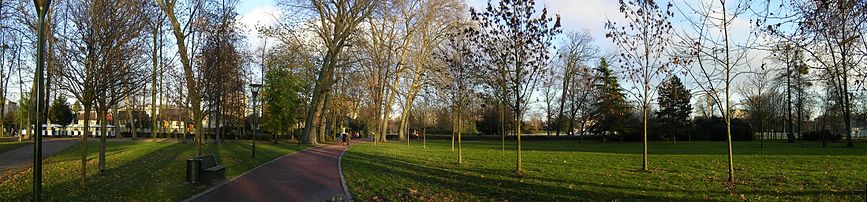 Parc Emile Fouchard
 -
 Île Refuge, in the Marne river, is part of the Local Nature Reserve of the islands of Chelles

-

-
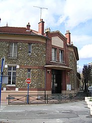
 Chelles-Gournay train station
 -
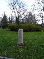 Where Roi Chilpéric was assassinated
 -
 Georges Brassens Chelles Library
 -
 Saint-André Church and Cemetery
 -
 Curie nursery
 -
 Avenue de la Résistance


See also
References
- ^ "Répertoire national des élus: les maires" (in French). data.gouv.fr, Plateforme ouverte des données publiques françaises. 13 September 2022.
- ^ "Populations légales 2021". The National Institute of Statistics and Economic Studies. 28 December 2023.
- ^ Des villages de Cassini aux communes d'aujourd'hui: Commune data sheet Chelles, EHESS (in French).
- ^ Population en historique depuis 1968, INSEE
- ^ "Éducation." Chelles. Retrieved on September 6, 2016.
- ^ "Liste des écoles, inscriptions et fonctionnement de l’école." Chelles. Retrieved on September 6, 2016.
- ^ a b "Collèges." Chelles. Retrieved on September 6, 2016.
- ^ a b "Lycées." Chelles. Retrieved on September 6, 2016.
- ^ "Médiathèque – Bibliothèque." Chelles. Retrieved on September 6, 2016.
- ^ "Musée Alfred-Bonno Archived 2016-09-21 at the Wayback Machine." Chelles. Retrieved on September 6, 2016.
- ^ "Piscine de Chelles Archived 2016-09-12 at the Wayback Machine." Chelles. Retrieved on September 6, 2016.
- ^ "Skatepark Archived 2016-09-20 at the Wayback Machine." Chelles. Retrieved on September 6, 2016.
External links
Wikimedia Commons has media related to Chelles, Seine-et-Marne.
- Official website (in French)
- 1999 Land Use, from IAURIF (Institute for Urban Planning and Development of the Paris-Île-de-France région) (in English)
- Base Mérimée: Search for heritage in the commune, Ministère français de la Culture. (in French)
| International | |
|---|---|
| National | |
| Geographic | |
| Other | |