
Clements, Minnesota
Clements | ||
|---|---|---|
FIPS code 27-11836[2] | | |
| GNIS feature ID | 0641326[3] | |

Clements is a city in
History
A post office has been in operation at Clements since 1900.[5] Clements was platted in 1902.[6] The city was named for Peter O. Clements, an early settler.[7]
Geography
According to the United States Census Bureau, the city has a total area of 0.38 square miles (0.98 km2), all land.[8]
Principal streets in Clements include County Road 16, which connects to
Demographics
| Census | Pop. | Note | %± |
|---|---|---|---|
| 1910 | 132 | — | |
| 1920 | 196 | 48.5% | |
| 1930 | 206 | 5.1% | |
| 1940 | 240 | 16.5% | |
| 1950 | 239 | −0.4% | |
| 1960 | 269 | 12.6% | |
| 1970 | 252 | −6.3% | |
| 1980 | 227 | −9.9% | |
| 1990 | 191 | −15.9% | |
| 2000 | 191 | 0.0% | |
| 2010 | 153 | −19.9% | |
| 2020 | 155 | 1.3% | |
| U.S. Decennial Census[9] | |||
44°22′54″N 95°03′09″W / 44.38167°N 95.05250°W
2010 census
As of the
There were 66 households, of which 28.8% had children under the age of 18 living with them, 57.6% were married couples living together, 4.5% had a female householder with no husband present, 1.5% had a male householder with no wife present, and 36.4% were non-families. 30.3% of all households were made up of individuals, and 13.7% had someone living alone who was 65 years of age or older. The average household size was 2.32 and the average family size was 2.88.
The median age in the city was 42.4 years. 24.8% of residents were under the age of 18; 3.3% were between the ages of 18 and 24; 25.5% were from 25 to 44; 31.3% were from 45 to 64; and 15% were 65 years of age or older. The gender makeup of the city was 53.6% male and 46.4% female.
2000 census
At the 2000
There were 76 households, of which 35.5% had children under the age of 18 living with them, 51.3% were married couples living together, 3.9% had a female householder with no husband present, and 39.5% were non-families. 32.9% of all households were made up of individuals, and 13.2% had someone living alone who was 65 years of age or older. The average household size was 2.51 and the average family size was 3.24.
Age distribution was 32.5% under the age of 18, 5.8% from 18 to 24, 29.8% from 25 to 44, 20.9% from 45 to 64, and 11.0% who were 65 years of age or older. The median age was 34 years. For every 100 females, there were 114.6 males. For every 100 females age 18 and over, there were 118.6 males.
The median household income was $35,000, and the median family income was $46,250. Males had a median income of $33,000 versus $16,406 for females. The
References
- ^ "2020 U.S. Gazetteer Files". United States Census Bureau. Retrieved July 24, 2022.
- ^ a b "U.S. Census website". United States Census Bureau. Retrieved January 31, 2008.
- ^ "US Board on Geographic Names". United States Geological Survey. October 25, 2007. Retrieved January 31, 2008.
- ^ "2010 Census Redistricting Data (Public Law 94-171) Summary File". American FactFinder. United States Census Bureau. Retrieved April 27, 2011.[dead link]
- ^ "Redwood County". Jim Forte Postal History. Retrieved February 28, 2015.
- ^ Chicago and North Western Railway Company (1908). A History of the Origin of the Place Names Connected with the Chicago & North Western and Chicago, St. Paul, Minneapolis & Omaha Railways. p. 57.
- ^ Upham, Warren (1920). Minnesota Geographic Names: Their Origin and Historic Significance. Minnesota Historical Society. p. 449.
- ^ "US Gazetteer files 2010". United States Census Bureau. Archived from the original on July 2, 2012. Retrieved November 13, 2012.
- ^ "Census of Population and Housing". Census.gov. Retrieved June 4, 2015.
- ^ "U.S. Census website". United States Census Bureau. Retrieved November 13, 2012.
Municipalities and communities of Redwood County, Minnesota, United States | ||
|---|---|---|
| Cities | 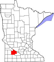 | |
| Townships | ||
Unincorporated communities | ||
| Indian reservation | ||
| Footnotes | ‡This populated place also has portions in an adjacent county or counties | |
| ||