
Copper Mountain, Colorado
Copper Mountain, Colorado | |
|---|---|
MDT) | |
| ZIP Code[4] | Frisco 80443 |
| Area code | 970 |
| GNIS feature | 2583226[1] |
Copper Mountain is an
Copper Mountain Ski Resort
and Copper Mountain village.
History
Copper Mountain was originally named "Wheeler" for a local judge and developer, and it has also been known as "Wheeler Station" in the past. The naming question was settled by a decision from the Board on Geographic Names, which ruled in favor of "Copper Mountain" in 1977.[1]
Geography
Copper Mountain is located approximately 20 miles (32 km) north-northeast of Leadville in the White River National Forest.
The Copper Mountain CDP has an area of 20,517 acres (83.030 km2), all land.[2]
Demographics
The
United States Census 2010
.
| Year | Pop. | ±% |
|---|---|---|
| 2010 | 385 | — |
| 2020 | 650 | +68.8% |
| Source: United States Census Bureau | ||
See also
- Silverthorne, CO Micropolitan Statistical Area
- White River National Forest
- Copper Mountain Ski Resort
References
- ^ a b c d e U.S. Geological Survey Geographic Names Information System: Copper Mountain, Colorado
- ^ a b "State of Colorado Census Designated Places - BAS20 - Data as of January 1, 2020". United States Census Bureau. Retrieved December 27, 2020.
- ^ a b United States Census Bureau. "Copper Mountain CDP, Colorado". Retrieved April 13, 2023.
- ^ a b "Zip Code 80443 Map and Profile". zipdatamaps.com. 2020. Retrieved December 27, 2020.
External links
Wikimedia Commons has media related to Copper Mountain, Colorado.
- Copper Mountain @ Colorado.com
- Copper Mountain @ UncoverColorado.com
- Copper Mountain Consolidated Metropolitan District website
- Copper Mountain Resort Association website
- Copper Mountain Ski Resort website
- Summit County website
- White River National Forest website
Municipalities and communities of Summit County, Colorado, United States | ||
|---|---|---|
| Towns | 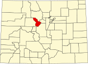 | |
| CDPs | ||
| Ghost towns |
| |
| ||
| International | |
|---|---|
| National | |