
Keystone, Colorado
Keystone, Colorado | |
|---|---|
MDT) | |
| ZIP Code[4] | 80435 |
| Area code | 970 |
| GNIS feature | 2408479[1] |
| Website | keystone |
[5] Keystone is a
Zip Code 80435) serves Keystone postal addresses.[4] The Keystone CDP includes the Keystone Resort and Keystone village. Keystone residents voted to incorporate in March 2023.[6]
Geography
The Keystone CDP has an area of 26,518 acres (107.316 km2), including 21 acres (0.086 km2) of water.[2]
Demographics
The
United States Census 2000
.
| Year | Pop. | ±% |
|---|---|---|
| 2000 | 825 | — |
| 2010 | 1,079 | +30.8% |
| 2020 | 1,369 | +26.9% |
| Source: United States Census Bureau | ||
Keystone Resort
Ralston Purina Company. It is now owned by Vail Resorts. The Keystone Resort ski
area occupies 3 separate mountains: Dercum Mountain, North Peak, and The Outback. Recent expansion of terrain and services offers snowcat skiing in Independence Bowl, Bergman Bowl, Erickson Bowl, in addition to the existing North Bowl and South Bowl on Wapiti Peak. The resort has many summer and winter outdoor activities. The winter activities include alpine skiing, snowboarding, tubing, ice-skating, cross-country skiing, horse-drawn sleigh ride dinners, and snowmobiling. The summer activities include hiking, mountain biking, fishing, trail running, golf on two championship courses, and paddle boating on Keystone Lake.

The Keystone ski area has:
- 2,870 acres (11.6 km2)
- 3,128 feet (953 m) vertical
- Base elevation: 9,280 feet (2,830 m)
- Summit elevation: 12,408 feet (3,782 m)
- 131 trails
- Degree of difficulty percentages for trails: Easiest-14 percent, More Difficult-29 percent, Most Difficult-57 percent
- 20 Lifts including 2 gondolas, 2 express six-pack and 4 high speed quads.
- The only Night skiing in the area.
Keystone is only a short drive from other resorts in Summit County - about 10 minutes to Arapaho Basin, 20 minutes to Breckenridge, and 20 minutes to Copper Mountain.
See also
- Silverthorne, CO Micropolitan Statistical Area
- White River National Forest
References
- ^ a b c d U.S. Geological Survey Geographic Names Information System: Keystone, Colorado
- ^ a b "State of Colorado Census Designated Places - BAS20 - Data as of January 1, 2020". United States Census Bureau. Retrieved December 27, 2020.
- ^ a b United States Census Bureau. "Keystone CDP, Colorado". Retrieved April 13, 2023.
- ^ a b "Look Up a ZIP Code". United States Postal Service. Retrieved December 27, 2020.
- ^ "The Town of Keystone Begins | Town of Keystone". keystone.colorado.gov. Retrieved April 30, 2024.
- ^ https://www.summitdaily.com/news/keystone-will-become-colorados-newest-town-following-incorporation-approval-tuesday/
External links
Keystone, Colorado at Wikipedia's sister projects
 Definitions from Wiktionary
 Media from Commons
 News from Wikinews
 Quotations from Wikiquote
 Texts from Wikisource
 Textbooks from Wikibooks
 Resources from Wikiversity
- Official website
- Keystone @ Colorado.com
- Keystone @ UncoverColorado.com
- Keystone @ SummitCove.com
- Keystone Resort website
- Summit County website
- White River National Forest website
Municipalities and communities of Summit County, Colorado, United States | ||
|---|---|---|
| Towns | 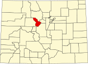 | |
| CDPs | ||
| Ghost towns |
| |
| ||
| Authority control databases: National |
|---|