
Corinth, Kentucky
Corinth, Kentucky | |
|---|---|
 Main Street | |
 Location of Corinth in Scott County, Kentucky. | |
| Coordinates: 38°30′24″N 84°36′52″W / 38.50667°N 84.61444°W | |
| Country | United States |
| State | Kentucky |
| Counties | Grant, Scott |
| Founded | 1868[1] |
| Government | |
| • Type | Mayor–council[2] |
| • Mayor | Billy Hill[2] |
| • Commissioner | Commissioners[3]
|
| • FIPS code | 21-17434 |
| GNIS feature ID | 2404131[5] |
| Website | corinth |
Corinth is a
The Grant County portion of Corinth is part of the
History
The Corinth community began in the late 1820s with the founding of Corinth Christian Church, but the post office was not established until 1868.
Geography
Corinth is located in southern Grant County. U.S. Route 25 passes through the center of town, leading north 11 miles (18 km) to Williamstown, the Grant County seat, and south 22 miles (35 km) to Georgetown, the Scott County seat. Interstate 75 crosses the city limits briefly, 1.5 miles (2.4 km) west of the center, at Exit 144 (Kentucky Route 330). I-75 leads north 48 miles (77 km) to Cincinnati and south 34 miles (55 km) to Lexington. KY 330 leads west 21 miles (34 km) to Owenton and northeast 22 miles (35 km) to Falmouth.
According to the United States Census Bureau, Corinth has a total area of 2.1 square miles (5.5 km2), of which 0.02 square miles (0.04 km2), or 0.79%, is water.[6]
Demographics
| Census | Pop. | Note | %± |
|---|---|---|---|
| 1900 | 331 | — | |
| 1910 | 252 | −23.9% | |
| 1920 | 241 | −4.4% | |
| 1930 | 328 | 36.1% | |
| 1940 | 210 | −36.0% | |
| 1950 | 283 | 34.8% | |
| 1960 | 238 | −15.9% | |
| 1970 | 236 | −0.8% | |
| 1980 | 258 | 9.3% | |
| 1990 | 137 | −46.9% | |
| 2000 | 181 | 32.1% | |
| 2010 | 232 | 28.2% | |
| 2020 | 226 | −2.6% | |
| U.S. Decennial Census[10] | |||
As of the
There were 75 households, out of which 33.3% had children under the age of 18 living with them, 45.3% were married couples living together, 10.7% had a female householder with no husband present, and 41.3% were non-families. 41.3% of all households were made up of individuals, and 21.3% had someone living alone who was 65 years of age or older. The average household size was 2.41 and the average family size was 3.34.
In the city the population was spread out, with 32.6% under the age of 18, 8.8% from 18 to 24, 23.8% from 25 to 44, 18.8% from 45 to 64, and 16.0% who were 65 years of age or older. The median age was 33 years. For every 100 females, there were 86.6 males. For every 100 females age 18 and over, there were 82.1 males.
The median income for a household in the city was $23,750, and the median income for a family was $27,750. Males had a median income of $28,125 versus $22,917 for females. The
Religion
There are six churches in Corinth:[11]
- Corinth Assembly of God
- Corinth Baptist Church
- Corinth Christian Church
- Lawrenceville Baptist Church[12]
- New Columbus Baptist Church[13]
- New Columbus United Methodist Church.[14]
References
- ^ a b c d e f Corinth, City of (September 1, 2009). "Kentucky: The City of Corinth - History". Kentucky, Commonwealth of. Archived from the original on April 9, 2010. Retrieved April 6, 2010.
- ^ a b Corinth, City of (September 1, 2009). "Kentucky: The City of Corinth - Home". Kentucky, Commonwealth of. Retrieved April 6, 2010.
- ^ a b c Corinth, City of (September 1, 2009). "Kentucky: The City of Corinth - City Commission". Kentucky, Commonwealth of. Archived from the original on April 9, 2010. Retrieved April 6, 2010.
- ^ "2020 U.S. Gazetteer Files". United States Census Bureau. Retrieved March 18, 2022.
- ^ a b U.S. Geological Survey Geographic Names Information System: Corinth, Kentucky
- ^ a b "Geographic Identifiers: 2010 Demographic Profile Data (G001): Corinth city, Kentucky". American Factfinder. U.S. Census Bureau. Retrieved December 6, 2016.[dead link]
- ^ a b "U.S. Census website". United States Census Bureau. Retrieved January 31, 2008.
- ^ Kentucky, University of (February 24, 2004). "Corinth, Kentucky". Kentucky Atlas & Gazetteer. Retrieved April 6, 2010.
- ^ Corinth, City of (September 1, 2009). "Kentucky: The City of Corinth - State Basketball Championship". Kentucky, Commonwealth of. Archived from the original on April 9, 2010. Retrieved April 6, 2010.
- ^ "Census of Population and Housing". Census.gov. Retrieved June 4, 2015.
- ^ Corinth, City of (September 1, 2009). "Kentucky: The City of Corinth - Places of Worship". Kentucky, Commonwealth of. Archived from the original on April 9, 2010. Retrieved April 6, 2010.
- ^ Southern Baptist Convention (2010). "Lawrenceville Baptist Church - Southern Baptist Church". Archived from the original on March 3, 2016. Retrieved April 6, 2010.
- ^ Southern Baptist Convention (2010). "New Columbus Baptist Church - Southern Baptist Church". Archived from the original on March 3, 2016. Retrieved April 6, 2010.
- ^ United Methodist Church. "Find-A-Church: New Columbus". Retrieved April 6, 2010.
External links
Municipalities and communities of Grant County, Kentucky, United States | ||
|---|---|---|
| Cities |  | |
| Unincorporated communities | ||
| Footnotes | ‡This populated place also has portions in an adjacent county or counties | |
| ||
Municipalities and communities of Scott County, Kentucky, United States | ||
|---|---|---|
| Cities | 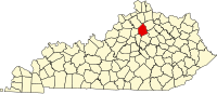 | |
| Other localities | ||
| Footnotes | ‡This populated place also has portions in an adjacent county or counties | |
| ||
| Central city |  | |
|---|---|---|
| Municipalities with population over 10,000 | ||
| Municipalities with population 5,000-10,000 | ||
| Municipalities with population under 5,000 | ||
| Counties | ||
| International | |
|---|---|
| National | |