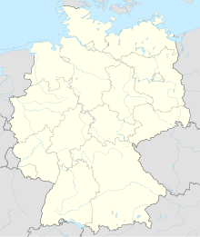
Cottbus-Drewitz Airport
Cottbus-Drewitz Airport Flugplatz Cottbus-Drewitz | |||||||||||||||
|---|---|---|---|---|---|---|---|---|---|---|---|---|---|---|---|
AMSL 276 ft / 84 m | | ||||||||||||||
| Coordinates | 51°53′22″N 14°31′55″E / 51.88944°N 14.53194°E | ||||||||||||||
| Website | www.flugplatz-drewitz.de | ||||||||||||||
| Map | |||||||||||||||
| Runways | |||||||||||||||
| |||||||||||||||
Cottbus-Drewitz Airport (
Ortsteil of Jänschwalde, approximately 25 kilometres (16 mi) north-east of Cottbus in Brandenburg, Germany
.
History
During
control tower
was opened.
The airport is most often used for
.In late May 2012, a grass strip at the airport was used to conduct unpaved runway trials of the
Airbus A400M military airlifter.[1] Although Airbus Military had examined the grass strip and believed it suitable, testing was cut short when the test aircraft penetrated the runway surface during a rejected takeoff test.[1] The test aircraft departed undamaged.[1]
Aside from a bistro serving the terminal, there is also a small aviation museum and flying school. The runway 07's centerline latitude is 51.885409 degrees and the longitude is 14.515136. Runway 25's centerline latitude is 51.893514 while the longitude is 14.549012 degrees.
The airport closed to all air traffic for the final time on 31 January 2020.Frankfurt-Hahn.
References
- ^ from the original on June 7, 2012, retrieved June 7, 2012,
Development aircraft MSN2 arrived at Cottbus-Drewitz airport on 22 May, following a transfer flight from Toulouse, France. It had been expected to remain at the location until the end of this week to perform landings on a grass strip at the site, but was involved in a minor incident during a test conducted the following day.
- ^ "Home". flugplatz-drewitz.de.
External links
- Official website (in German)

