
Cumberland, Wisconsin
Cumberland, Wisconsin | ||
|---|---|---|
City | ||
FIPS code 55-18025[5] | | |
| GNIS feature ID | 1563618[2] | |
| Website | http://www.cityofcumberland.net | |
Cumberland is a city in
History
Cumberland is often called the "Island City". The main part of the city, including the original settlement, is located on land surrounded by Beaver Dam Lake, originally settled by the Chippewa Indian tribe. Beaver Dam Lake was referred to as Che-wa-cum-ma-towangok or "Lake Made by the Beavers" by the local tribe. The Chief of the Chippewa tribe was Pon-gee Rau-gen, or "Little Pipe". He continued to live in the area even after it was settled by European settlers, and drowned in a canoe on Beaver Dam Lake in 1895.
In 1874, A. Ritan and R. H. Clothier explored the area with the intention of settling in there. While exploring, they came across surveyors who informed them of the upcoming railroad line that the North Wisconsin Railway Company planned to lay in the area. A. Ritan, who lived near what is today Turtle Lake, and the Dahlby family, originally of Norwegian descent, from the town of New Richmond, both filed a homestead near the proposed railroad and built two log cabins 300 feet north of the present high school location.
In 1878, the North Wisconsin Railroad Company extended the rail lines through the area. Prior to the railroad, settlers were required to get provisions in Rice Lake, Barron or Clayton. In 1880, the Dahlby family sold their cabin, moved to Chandler (now known as Spooner), and opened a store. A. Ritan, also originally from Norway, lived in Cumberland for many years and helped develop the city before moving to Portland, Oregon.[7]
R. H. Clothier also took a homestead and built a farm in 1875.
On December 30, 1875, the town of Lakeside was organized, encompassing what is now Lakeland Township, Almena Township, Crystal Lake Township and Maple Plain Township. During the winter of 1876, Bonett Bridge was built off the island. Soon a school was located on the mainland area near the bridge with Miss Ida Schofield as the original teacher. She was soon replaced by Miss Carrie Fay, who arrived from nearby
Geography
Cumberland is located at 45°32′9″N 92°1′24″W / 45.53583°N 92.02333°W (45.535892, −92.023389),[8] along Beaver Dam Lake at the beginning of the Hay River.
According to the United States Census Bureau, the city has a total area of 4.04 square miles (10.46 km2), of which, 3.45 square miles (8.94 km2) is land and 0.59 square miles (1.53 km2) is water.[9]
Cumberland is along
Climate
| Climate data for Cumberland, Wisconsin, 1991–2020 normals, extremes 1932–present | |||||||||||||
|---|---|---|---|---|---|---|---|---|---|---|---|---|---|
| Month | Jan | Feb | Mar | Apr | May | Jun | Jul | Aug | Sep | Oct | Nov | Dec | Year |
| Record high °F (°C) | 54 (12) |
57 (14) |
80 (27) |
92 (33) |
104 (40) |
98 (37) |
107 (42) |
101 (38) |
95 (35) |
88 (31) |
74 (23) |
60 (16) |
107 (42) |
| Mean maximum °F (°C) | 38.9 (3.8) |
44.4 (6.9) |
59.2 (15.1) |
74.6 (23.7) |
82.6 (28.1) |
88.9 (31.6) |
89.7 (32.1) |
89.2 (31.8) |
84.5 (29.2) |
75.9 (24.4) |
58.7 (14.8) |
43.1 (6.2) |
91.8 (33.2) |
| Mean daily maximum °F (°C) | 19.1 (−7.2) |
24.3 (−4.3) |
37.1 (2.8) |
51.6 (10.9) |
64.7 (18.2) |
74.7 (23.7) |
79.0 (26.1) |
76.9 (24.9) |
68.5 (20.3) |
54.0 (12.2) |
38.0 (3.3) |
24.3 (−4.3) |
51.0 (10.6) |
| Daily mean °F (°C) | 9.7 (−12.4) |
13.5 (−10.3) |
26.3 (−3.2) |
41.0 (5.0) |
54.4 (12.4) |
64.8 (18.2) |
69.2 (20.7) |
67.1 (19.5) |
58.3 (14.6) |
44.5 (6.9) |
30.0 (−1.1) |
16.5 (−8.6) |
41.3 (5.1) |
| Mean daily minimum °F (°C) | 0.3 (−17.6) |
2.7 (−16.3) |
15.5 (−9.2) |
30.4 (−0.9) |
44.0 (6.7) |
54.9 (12.7) |
59.4 (15.2) |
57.3 (14.1) |
48.1 (8.9) |
35.1 (1.7) |
22.0 (−5.6) |
8.7 (−12.9) |
31.5 (−0.3) |
| Mean minimum °F (°C) | −19.8 (−28.8) |
−17.1 (−27.3) |
−7.3 (−21.8) |
16.9 (−8.4) |
33.0 (0.6) |
43.1 (6.2) |
50.4 (10.2) |
49.1 (9.5) |
35.1 (1.7) |
24.2 (−4.3) |
7.0 (−13.9) |
−11.9 (−24.4) |
−22.3 (−30.2) |
| Record low °F (°C) | −43 (−42) |
−52 (−47) |
−37 (−38) |
−4 (−20) |
18 (−8) |
31 (−1) |
36 (2) |
30 (−1) |
19 (−7) |
6 (−14) |
−16 (−27) |
−39 (−39) |
−52 (−47) |
| Average precipitation inches (mm) | 0.95 (24) |
0.99 (25) |
1.69 (43) |
2.83 (72) |
3.84 (98) |
4.54 (115) |
4.47 (114) |
4.40 (112) |
3.61 (92) |
3.28 (83) |
1.86 (47) |
1.29 (33) |
33.75 (858) |
| Average snowfall inches (cm) | 11.4 (29) |
10.6 (27) |
9.2 (23) |
4.6 (12) |
0.4 (1.0) |
0.0 (0.0) |
0.0 (0.0) |
0.0 (0.0) |
0.0 (0.0) |
0.7 (1.8) |
7.1 (18) |
11.6 (29) |
55.6 (140.8) |
| Average precipitation days (≥ 0.01 in) | 8.6 | 6.3 | 7.1 | 10.4 | 11.0 | 11.3 | 10.0 | 10.0 | 9.6 | 10.2 | 7.9 | 8.8 | 111.2 |
| Average snowy days (≥ 0.1 in) | 7.8 | 5.5 | 4.0 | 2.0 | 0.1 | 0.0 | 0.0 | 0.0 | 0.0 | 0.6 | 3.5 | 7.3 | 30.8 |
| Source 1: NOAA[10] | |||||||||||||
| Source 2: National Weather Service[11] | |||||||||||||
Demographics
| Census | Pop. | Note | %± |
|---|---|---|---|
| 1880 | 246 | — | |
| 1890 | 1,219 | 395.5% | |
| 1900 | 1,328 | 8.9% | |
| 1910 | 1,445 | 8.8% | |
| 1920 | 1,528 | 5.7% | |
| 1930 | 1,532 | 0.3% | |
| 1940 | 1,539 | 0.5% | |
| 1950 | 1,872 | 21.6% | |
| 1960 | 1,860 | −0.6% | |
| 1970 | 1,839 | −1.1% | |
| 1980 | 1,983 | 7.8% | |
| 1990 | 2,163 | 9.1% | |
| 2000 | 2,280 | 5.4% | |
| 2010 | 2,170 | −4.8% | |
| 2019 (est.) | 2,103 | [4] | −3.1% |
| U.S. Decennial Census[12] | |||
2010 census
As of the census
There were 994 households, of which 23.9% had children under the age of 18 living with them, 41.0% were married couples living together, 12.2% had a female householder with no husband present, 4.1% had a male householder with no wife present, and 42.7% were non-families. 36.3% of all households were made up of individuals, and 20.5% had someone living alone who was 65 years of age or older. The average household size was 2.14 and the average family size was 2.76.
The median age in the city was 47.2 years. 20.8% of residents were under the age of 18; 7.4% were between the ages of 18 and 24; 19.8% were from 25 to 44; 27% were from 45 to 64; and 24.9% were 65 years of age or older. The gender makeup of the city was 46.3% male and 53.7% female.
2000 census
As of the census
The ancestral makeup of the population were 34.2% German, 24.7%
There were 1,013 households, out of which 26.4% had children under the age of 18 living with them, 44.7% were married couples living together, 11.7% had a female householder with no husband present, and 40.0% were non-families. 35.1% of all households were made up of individuals, and 19.6% had someone living alone who was 65 years of age or older. The average household size was 2.18 and the average family size was 2.79.
In the city, the population was spread out, with 22.5% under the age of 18, 7.3% from 18 to 24, 23.0% from 25 to 44, 22.9% from 45 to 64, and 24.3% who were 65 years of age or older. The median age was 43 years. For every 100 females, there were 89.8 males. For every 100 females age 18 and over, there were 82.2 males.
The median income for a household in the city was $32,661, and the median income for a family was $41,612. Males had a median income of $34,519 versus $21,304 for females. The per capita income for the city was $18,688. About 9.5% of families and 11.7% of the population were below the poverty line, including 18.6% of those under age 18 and 8.3% of those age 65 or over.

Transportation
Cumberland Municipal Airport (KUBE) is located three miles south of Cumberland.
Recreation
Cumberland is known as "The Island City" because it is nearly surrounded by the waters of Beaver Dam Lake.[13]
Cumberland hosts the "Rutabaga Festival" annually on the weekend preceding Labor Day weekend. The festival features live music, carnival rides, food, a parade, and other events.[13]
Notable people
- NFLPlayer
- Henry C. Doolittle – Wisconsin State Representative
- NHLPlayer
- Fred J. Moser – Wisconsin State Representative, Educator
- Ben Peterson – Olympic Gold Medalist
- John Peterson – Olympic Gold Medalist
- Thomas St. Angelo – Wisconsin State Representative
- Sister M. Madeleva Wolff– Poet, College President
- Roger A Towberman - Chief Master Sergeant, United States Space Force
Images
-
 The sign for Cumberland on US63
 -
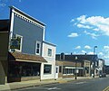 Street scene of Cumberland
 -
 Uecke's Opera House in Cumberland
 -
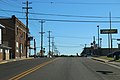 Intersection of US63 and WIS48


References
- ^ "2019 U.S. Gazetteer Files". United States Census Bureau. Retrieved August 7, 2020.
- ^ a b "US Board on Geographic Names". United States Geological Survey. October 25, 2007. Retrieved January 31, 2008.
- ^ a b "U.S. Census website". United States Census Bureau. Retrieved November 18, 2012.
- ^ a b "Population and Housing Unit Estimates". United States Census Bureau. May 24, 2020. Retrieved May 27, 2020.
- ^ a b "U.S. Census website". United States Census Bureau. Retrieved January 31, 2008.
- ^ "Cumberland, Wisconsin (WI 54829) profile: Population, maps, real estate, averages, homes, statistics, relocation, travel, jobs, hospitals, schools, crime, moving, houses, news, sex offenders".
- ^ a b Newton S. Gordon and Franklyn Curtiss-Wedge. History of Barron County, Wisconsin. Minneapolis, Minn.: H.C. Cooper, 1922, pp. 1087–1101.
- ^ "US Gazetteer files: 2010, 2000, and 1990". United States Census Bureau. February 12, 2011. Retrieved April 23, 2011.
- ^ "US Gazetteer files 2010". United States Census Bureau. Archived from the original on January 12, 2012. Retrieved November 18, 2012.
- ^ "U.S. Climate Normals Quick Access – Station: Cumberland, WI". National Oceanic and Atmospheric Administration. Retrieved March 5, 2023.
- ^ "NOAA Online Weather Data – NWS Minneapolis". National Weather Service. Retrieved March 5, 2023.
- ^ "Census of Population and Housing". Census.gov. Retrieved June 4, 2015.
- ^ a b "Home". cumberland-wisconsin.com.
External links
- Cumberland website
- Cumberland Chamber of Commerce
- Thomas St. Angelo Public Library of Cumberland, WI
- Sanborn fire insurance maps: 1893 1899 1909
 | ||||
Villages | ||||
Towns | ||||
| CDP | ||||
| Unincorporated communities | ||||
| Indian reservations | ||||
| Footnotes | ‡This populated place also has portions in an adjacent county or counties | |||
| ||||
| International | |
|---|---|
| National | |
| Geographic | |