
Dahan River
25°02′33″N 121°29′02″E / 25.0426°N 121.4840°E
| Dahan River | |
|---|---|
Pintian Mountain | |
| • location | Hsinchu County |
| • elevation | 3,420 m (11,220 ft) |
| Mouth | |
• location | Tamsui River, Sanchong District, New Taipei City |
• elevation | 10 m (33 ft) |
| Length | 135 km (84 mi) |
| Basin size | 1,163 km2 (449 sq mi) |
| Discharge | |
| • location | mouth |
| • average | 59.62 m3/s (2,105 cu ft/s) |
| • minimum | 22.94 m3/s (810 cu ft/s) |
| • maximum | 13,800 m3/s (490,000 cu ft/s) |
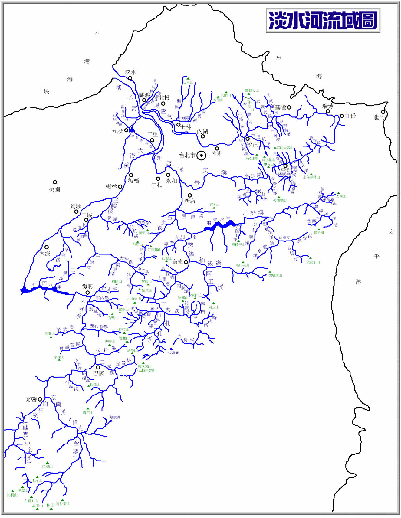
The Dahan River (
Geography and geology
The Dahan River begins on

The Dahan River once flowed north through the area of
Dams

Due to the lack of a natural water source for the Taoyuan plateau, thousands of artificial ponds were constructed to capture summer rainfall for irrigation, making the area one of Taiwan's most productive agricultural regions. In 1928 the Taoyuan Canal was dug to divert water from the Dahan River near the present location of Shihmen Dam. The canal enabled a more constant water supply for Taoyuan and effectively returned water to old channels of the river that had been cut off thousands of years ago. Due to urbanization, the Dahan river is increasing in importance as a domestic water source, while the use for irrigation has decreased.
The Shihmen Dam, one of Taiwan's first multi-purpose water projects, was completed in 1964. It provides flood control, irrigation, domestic water supply and hydroelectricity for much of Taoyuan and New Taipei City. The dam has had problems with
The Taiwanese government has proposed the construction of a mega-dam on the Takekan Creek known as Gaotai Dam (高台壩) to trap silt and provide additional water storage. This plan has been criticized due to its potential environmental damage, and its limited useful life, because the new reservoir would also eventually fill with silt.
Bridges
See also
- List of rivers in Taiwan
References
- ^ Imagephilip.pristine.net Archived 2017-01-13 at the Wayback Machine
- ^ "新北市觀光旅遊網". 新北市觀光旅遊網. Retrieved 16 April 2023.