
Del Muerto, Arizona
Del Muerto, Arizona | ||
|---|---|---|
FIPS code 04-18490 | | |
| GNIS feature ID | 2582771[2] | |
Del Muerto is a
2010 census.[4]
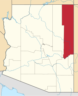
Geography
Del Muerto is located about 9 miles (14 km) east of
Canyon de Chelly
.
According to the United States Census Bureau, the CDP has a total area of 1.0 square mile (2.6 km2), all land.[4]
Education
The community is within the Chinle Unified School District,[5] which operates Chinle High School.
Demographics
| Census | Pop. | Note | %± |
|---|---|---|---|
| 2020 | 258 | — | |
| U.S. Decennial Census[6] | |||
References
- ^ "2020 U.S. Gazetteer Files". United States Census Bureau. Retrieved October 29, 2021.
- ^ a b U.S. Geological Survey Geographic Names Information System: Del Muerto, Arizona
- ^ "Del Muerto AZ ZIP Code". zipdatamaps.com. 2023. Retrieved May 3, 2023.
- ^ a b "Geographic Identifiers: 2010 Demographic Profile Data (G001): Del Muerto CDP, Arizona". U.S. Census Bureau, American Factfinder. Archived from the original on February 12, 2020. Retrieved April 18, 2013.
- .
- ^ "Census of Population and Housing". Census.gov. Retrieved June 4, 2016.
 | ||||
Towns | ||||
| CDPs |
| |||
| Populated places | ||||
| Indian reservations | ||||
Ghost towns | ||||
| Footnotes | ‡This populated place also has portions in an adjacent county or counties | |||
| ||||