
Dollis Valley Greenwalk
| Dollis Valley Greenwalk | |
|---|---|
 The Dollis Valley Greenwalk's logo, a white arrow on green, marks the route | |
| Length | 10 mi (16 km) |
| Location | London Borough of Barnet, England |
| Use | Hiking |
| Season | All year |
The Dollis Valley Greenwalk (or Green Walk) is a footpath
History
Dollis Valley Greenwalk is based on the Brookside Walk, built by Finchley Council (now part of Barnet) in the 1930s.[6] It was the brainchild of leading Finchley Councillor, Alfred Pike, and followed Mutton Brook west from Falloden Way to its junction with Dollis Brook, and then the Dollis north to the Finchley boundary in Wyatts Farm Open Space, opposite Walfield Avenue. Mutton Brook was the southern boundary of the borough and Dollis Brook the western one, and the walk was almost all built on the Finchley side. At Westbury Road, the gardens come down to the brook, so Pike persuaded Hendon Councillors to acquire the land on their side of the brook so that the walk could cross over to the Hendon side for this stretch.[7]
The Greenwalk itself was developed by the London Borough of Barnet with the Countryside Commission (now Natural England) and the Countryside Management Service. In March 2009, the Dollis Valley Greenwalk won a £400,000 grant from the Mayor of London's Help a London park scheme by public vote.[5][8] The grant was planned to be used to improve footpaths, cycle paths, lighting, entrances for safer walking, accessibility, which includes making it a safe route for walking between communities and play facilities. It was also used for the improvement of existing habitats and the creation of new ones such as wetland woodland and reedbed, enhancement of hay meadows, landscaping, and finally the addition of information boards, fingerposts and other features to increase enjoyability and awareness of points of interest.[5]
Route
Starting at the northern end, the route commences in
The southern end starts on the edge of Hampstead Heath Extension at the end of a short pathway from Meadway Close, Hampstead Garden Suburb. It goes along Meadway Close and Bigwood Road to
In the next section, the route turns right to a footbridge across the brook and then turns left along Holden Road, left again down Tillingham Way and then right to rejoin Dollis Brook in Laurel Way Open Space. It crosses Laurel Way and then goes through the meadowland and trees of Whetstone Stray to Totteridge Lane. It turns right along the Lane and then left just before
The route continues through Brook Farm Open Space and Wyatts Farm Open Space to Western Way, and then through Barnet Playing Fields to Barnet Lane and Dollis Brook Walk. It then keeps to the right of the brook through Ducks Island until a narrow metal bridge. It crosses the bridge and turns right through fields for 1000 yards (leaving Dollis Brook, which now goes through private land) until it reaches a playing field, which is exited by a gap in the hedge on the left, It then goes through
Gallery
-
-
 Big Wood, Hampstead Garden Suburb
 -
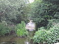 Hendon Lane Weir, Dollis Brook
 -
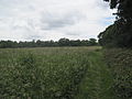
 Windsor Open Space, Finchley
 -
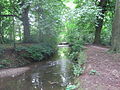 Dollis Brook near Dollis Brook Viaduct
 -
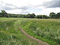
 Whetstone Stray, Whetstone
 -
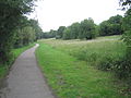
 Dollis Brook in Wyatt Farm Open Space, Whetstone
 -
 Totteridge Park Open Space
 -
-
 Source of Dollis Brook,Moat Mount Open Space


See also
- Parks and open spaces in Barnet
References
- ^ "Dollis Valley Greenwalk – Path Details". Long Distance Walkers Association Ltd. Retrieved 10 June 2009.
- ^ "Dollis Valley Greenwalk (Barnet)". Hertfordshire County Council. Archived from the original on 12 September 2012. Retrieved 10 June 2009.
- ^ "Barnet Council staff walk to talk about the Dollis Valley Green Walk". Edgware & Mill Hill Times. 16 April 2009. Retrieved 21 May 2009.
- ^ "Dollis Valley Greenwalk". The Long Distance Walkers Association. 2008. Retrieved 21 May 2009.
- ^ a b c "Barnet Online – Dollis Valley Green Walk". London Borough of Barnet. Archived from the original on 17 March 2009. Retrieved 10 June 2009.
- ^ Following the Brent quotes a letter of complaint about the construction work in 1937.
- ^ Reminiscence of Alfred Pike in Percy Reboul compiler, Barnet Voices, Tempus 1999, p. 25.
- ^ Bradford, Kevin (11 March 2009). "Residents delighted at £400,000 green spaces grant". Barnet Times. Retrieved 10 June 2009.
- London Loop between Moat Mount and Barnet Lane, and the London Loop 16 guide Archived 16 July 2011 at the Wayback Machinegives instructions for following this part of the Greenwalk