
Elgin, Arizona
Elgin, Arizona | ||
|---|---|---|
FIPS code 04-22150 | | |
| GNIS feature ID | 28852[2] | |
Elgin is a
Geography
Elgin is located along the Babocomari River at 31°37′45″N 110°34′19″W / 31.62917°N 110.57194°W (31.629095, -110.571951).[4] The Babocomari is known to harbor a unique species of fish, belonging to the family Characidae. They are incredibly rare and little is known about them. According to the United States Census Bureau, the CDP has a total area of 5.9 square miles (15.4 km2), all land.[3]
Climate
According to the
Demographics
| Census | Pop. | Note | %± |
|---|---|---|---|
| 2020 | 162 | — | |
| U.S. Decennial Census[6] | |||
As of the
There were 123 households, out of which 29% had children under the age of 18 living with them, 64% were married couples living together, 4% had a female householder with no husband present, and 29% were non-families. 24% of all households were made up of individuals, and 3% had someone living alone who was 65 years of age or older. The average household size was 2.5 and the average family size was 3.0.
In the CDP, the population was spread out, with 27% under the age of 18, 4% from 18 to 24, 25% from 25 to 44, 32% from 45 to 64, and 13% who were 65 years of age or older. The median age was 43 years. For every 100 females, there were 116 males. For every 100 females age 18 and over, there were 100 males.
The median income for a household in the CDP was $64,167, and the median income for a family was $66,250. Males had a median income of $38,500 versus $21,250 for females. The
Film
The train station sequence in the 1955 film classic
Winemaking
Elgin is the first location in Arizona to engage in commercial scale winemaking. In the 1970s, Gordon Dutt, Ph.D., a soil scientist from the University of Arizona, was intrigued with the similarity between the soil of the Elgin-Sonoita area and that of Burgundy, France. In partnership with A. Blake Brophy, he developed an experimental winery that later developed into the Sonoita Vineyards and that encouraged other vineyards in the area. Presently, growers in the area produce Chardonnay, Sauvignon Blanc, Cabernet Sauvignon, Merlot, Pinot Noir, Mission, and Syrah grapes. In 2009 there were nine vineyards in the region, producing about 50,000 gallons of wine yearly.[8]
Elgin hosts several wine festivals throughout the year, most notably the St. Martin's Day festival and the Fall festival.
The expansion of winemaking in the Elgin-Sonoita area has led to establishment of fine restaurants and bed and breakfasts and has regenerated the economy of this lightly populated, rural area.[9]
Gallery
-
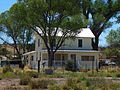
 Elgin Community Club building.
 -
 The historic 1915 schoolhouse was also used as a dance hall.
 -
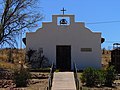 The Chapel of Santa Maria Catholic church in Elgin.
 -
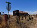
 Former New Mexico & Arizona Railroadsection house.
 -
 Historic service station building.


References
- ^ "2020 U.S. Gazetteer Files". United States Census Bureau. Retrieved October 29, 2021.
- ^ a b U.S. Geological Survey Geographic Names Information System: Elgin, Arizona
- ^ a b "Geographic Identifiers: 2010 Demographic Profile Data (G001): Elgin CDP, Arizona". U.S. Census Bureau, American Factfinder. Archived from the original on February 12, 2020. Retrieved December 4, 2012.
- ^ "US Gazetteer files: 2010, 2000, and 1990". United States Census Bureau. February 12, 2011. Retrieved April 23, 2011.
- ^ Climate Summary for Elgin, Arizona
- ^ "Census of Population and Housing". Census.gov. Retrieved June 4, 2016.
- ^ "U.S. Census website". United States Census Bureau. Retrieved January 31, 2008.
- ^ "Wineries Near 85611".
- ^ "お酒の友、オルニチン".
 | ||||
Town | ||||
| CDPs | ||||
| Populated places | ||||
| Ghost towns | ||||
| ||||