
Ferry Hinksey Road

Ferry Hinksey Road is a road in west
Osney Mead Industrial Estate to the east, started in 1961.[2] To the east is Osney Ditch
.
History
The road is named after the village of
Ferry Hinksey, now known as North Hinksey, on the other side of Hinksey Stream, one of the branches of the River Thames in Oxford. There was once a punt ferry that operated over Bulstake Stream.[3]
The most notable path between Oxford and North Hinksey, a continuation of Ferry Hinksey Road, is a metalled
bridleway and cycle track, variously known as Willow Walk and Ruskin's Ride. The latter is named after John Ruskin (1819–1900) who used to pass this way between Ferry Hinksey and Oxford, where he was the first Slade Professor of Fine Art from 1869.[4] The path was originally built in 1876–77 by Aubrey Harcourt (1852–1904), a major local landowner,[5]
but was not made open to the public until 1922. There is also a smaller unmade path which begins alongside the large back garden of The Fishes and crosses Hinksey Stream by a bridge at the site of the old ferry, which linked Ferry Hinksey with Oxford. The ferry ceased operation in 1928. The various streams are now crossed by small bridges. A 'Ferry Cottage' still remains.
A poem called Ferry Hinksey by Laurence Binyon (1869–1943) describes the bucolic nature of the area before Osney Mead Industrial Estate was developed.[3]
Buildings and companies
Times in 1970–2.[6]
West Oxford Community Primary School,distance learning company, is at King's Meadow off Ferry Hinksey Road.[9]
Gallery
-
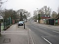 View of Ferry Hinksey Road
 -
 Footpath andcycleway to North Hinkseyoff Ferry Hinksey Road
 -
 Bridge off Ferry Hinksey Road to the right
 -
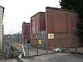 The large electrical substation on Ferry Hinksey Road
 -
 playing fieldsby Ferry Hinksey Road
 -
 Sports fieldoff Ferry Hinksey Road
 -
 View of West Oxford Community Primary School
 -
 Ferry Hinksey late 1800s


See also
- Ruskin's diggersat Ferry Hinksey (1874)
References
- ^ "Sold House Prices on Ferry Hinksey Road". Oxford Mail. Retrieved 8 August 2011.
- ISBN 978-1-899536-99-3.
- ^ ISBN 0-333-39917-X.
- ISBN 1-85619-580-5.
- ^ Hanson, W. J. (1996). A Thousand Years: A study of the interaction between people and environment in the Cumnor, Wytham and North Hinksey Area. Wytham Publications.
- ISBN 0-14-071045-0.
- ^ "Contact Us". westoxfordschool.co.uk. UK: West Oxford Community Primary School. Archived from the original on 30 March 2012. Retrieved 8 August 2011.
- Office for Standards in Education, UK.
- ^ "Contact us". ool.co.uk. UK: Oxford Open Learning. Retrieved 8 August 2011.
51°45′02″N 1°16′35″W / 51.75054°N 1.27643°W
This Oxfordshire location article is a stub. You can help Wikipedia by expanding it. |
This England road or road transport-related article is a stub. You can help Wikipedia by expanding it. |