
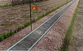
Cycle track


A cycle track or cycleway (British) or bikeway[1] (mainly North American), sometimes historically[2] referred to as a sidepath, is a separate route for cycles and not motor vehicles. In some cases cycle tracks are also used by other users such as pedestrians and horse riders (see shared-use route). A cycle track can be next to a normal road, and can either be a shared route with pedestrians (common in countries such as the United Kingdom) or be made distinct from both the pavement and general roadway by vertical barriers or elevation differences.[3][4]
In urban planning, cycle tracks are designed to encourage cycling and reduce motor vehicle congestion and pollution, cycling accidents (by alleviating the conflict between motor vehicles and cycles sharing the same road space) and general confusion and inconvenience for road users.
Cycle tracks may be one-way or two-way, and may be at road level, at sidewalk level, or at an intermediate level. When located alongside normal roads, they usually have some separation from motor traffic in the form of bollards, car parking, barriers or boulevards.[3] Barriers may include curbs, concrete berms, posts, planting/median strips, walls, trenches, or fences. They are often accompanied by a curb extension or other features at intersections to simplify crossing.
In the UK, a cycle track is a road specifically for use by cyclists and not motor vehicles. In Ireland the term cycle track also includes cycle lanes marked on the carriageway, but only if accompanied by a specific sign. In the UK, a cycle track may be alongside a roadway (or carriageway) for all vehicles or it may be on its own alignment. The term does not include cycle lanes or other facilities within an all-vehicle carriageway.[5]
Impact
Levels of bicycle traffic

In the United States, an academic analysis of eight cycle tracks found that they had increased bike traffic on the street by 75 percent within one year of installation.[6] Rider surveys indicated that 10 percent of riders after installation would have chosen a different mode for that trip without the cycle track, and 25 percent said they were biking more in general since the installation of the cycle track.[7] However, scientific research indicates that different groups of cyclists show varying preferences of which aspects of cycling infrastructure are most relevant when choosing a specific cycling route over another; thus these different preferences need to be accounted for in order to maximize utilization of new cycling infrastructure.[8]
A 2015 study of a street in Toronto, Canada where cycle tracks replaced a painted cycle lane involved a survey of cyclists. Results reported 38% would use other travel modes than cycling before the redevelopment (most of whom would take transit). An improvement to safety was the most commonly cited reason.[9]
Safety
Recent studies generally affirm that segregated cycle tracks have a better safety record between intersections than cycling on major roads in traffic.[10] The increase in cycling caused by cycle tracks may lead to a "safety in numbers" effect though some contributors caution against this hypothesis.[11][12] Older studies tended to come to negative conclusions about mid-block cycle track safety.[13][14][15][16]
The implications for road safety of cycle tracks at intersections is disputed. Studies generally show an increase in collisions at junctions, especially where cyclists are travelling in the direction opposite to the flow of traffic (e.g. on two-way cycle tracks). Protected intersection designs generally improve safety records over non-protected junction types.[17][18][19]
Specifications
Netherlands
The Dutch guidance for cycle traffic specifies that one-way cycle paths should be a minimum width of 2 metres.
United Kingdom
The LTN 1/20 guidance covers cycle infrastructure design in England and Northern Ireland. LTN 1/20 states that one-way cycle tracks should be a minimum of 1.5-2.5 metres depending on the number of cyclists. Two-way cycle tracks should be a minimum of 2-4 m, depending on the number of cyclists.[20]
Cycling by Design covers cycle infrastructure design in Scotland. It specifies a width of minimum width varying from 1.5 to 2.5 metres for one-way tracks and between 2 and 4 metres for two-way tracks. Shared pedestrian tracks should only be used if there are less than 300 cycles per hour at the peak hour and it should be 4 metres (2.5 metres at minimum).[21]
Gallery
-
 A two-way separated bike lane in Washington, D.C., with parked cars acting as a barrier between bicyclists and traffic
 -
 Cycle tracks with concrete barriers in downtown Ottawa, Ontario, Canada, on Laurier Avenue in 2011
 -
 Separate traffic light for automobiles and bicycles on cycle track in Denmark
 -
 Cycle track with green lanes through intersection in Ottawa, Ontario, Canada (also on Laurier), in 2011
 -
.jpg)


See also
- Bikeway safety, including studies on the safety of cycle tracks
- Bikeway and legislation
- Bikeway controversies
- Bikeways
- Cycling infrastructure
- List of cycleways
- Outline of cycling
- Rail trail
References
- ^ "Separated Bike Lane Planning and Design Guide - Publications - Bicycle and Pedestrian Program - Environment - FHWA".
- ^ "Historian uncovers the forgotten U.S. protected bike lane boom of 1905". 2014-02-18. Archived from the original on 2015-12-12. Retrieved 2015-11-03.
- ^ a b "Cycle Tracks - National Association of City Transportation Officials". 2011-12-14.
- ^ "The Green Lane Project's style guide". Archived from the original on 2015-10-25. Retrieved 2015-11-03.
- ^ "Department for Transport - GOV.UK".
- ^ "Lessons from the Green Lanes: Evaluating Protected Bike Lanes in the U.S. - Transportation Research and Education Center".
- ^ "Separated Bike Lane Planning and Design Guide - Separated Bike Lane Planning and Design Guide - Publications - Bicycle and Pedestrian Program - Environment - FHWA".
- )
- S2CID 131245911.
- PMID 19845962.
- ^ Pucher, John (Fall 2001). "Cycling Safety on Bikeways vs. Roads" (PDF). Transportation Quarterly: Ideas in Motion. pp. 9–11. Retrieved 5 October 2022.
- PMID 21094319.
- ^ Berlin Police Department study, 1987, in English translation and in the original German, with commentaries (accessed 8 July 2007)
- ^ Franklin, John (1999). "Two decades of the Redway cycle paths of Milton Keynes". Traffic Engineering & Control (July/August 1999). Hemming.
- ^ Franklin, John (2001). "Cycling in the wrong direction". Traffic Engineering & Control (May 2001). Hemming.
- ^ Franklin, John (2002). Achieving Cycle-Friendly Infrastructure. Cycle-Friendly Infrastructure Conference. University of Nottingham.
- PMID 19845962.
- PMID 19845962.
- PMID 26562673.
- ^ Cycle Infrastructure Design (PDF) (Report). Department of Transport (UK). July 2020.
- ^ Cycling by Design (PDF) (Report). Transport Scotland. September 2021.
| In-roadway bikeways |
| ||||||
|---|---|---|---|---|---|---|---|
| Right-of-way paths |
| ||||||
| Health, safety and infrastructure |
| ||||||
| Design Guidelines |
| ||||||