
Freilassing
Freilassing | |
|---|---|
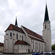
 Saint Rupert Church in Freilassing | |
 Coat of arms | |
Location of Freilassing within Berchtesgadener Land district 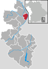 | |
Berchtesgadener Land | |
| Government | |
| • Mayor (2020–26) | Markus Hiebl[1] |
| Area | |
| • Total | 14.79 km2 (5.71 sq mi) |
| Elevation | 423 m (1,388 ft) |
| Population (2022-12-31)[2] | |
| • Total | 17,816 |
| • Density | 1,200/km2 (3,100/sq mi) |
| Time zone | UTC+01:00 (CET) |
| • Summer (DST) | UTC+02:00 (CEST) |
| Postal codes | 83395 |
| Dialling codes | 08654 |
| Vehicle registration | BGL |
| Website | www.freilassing.de |
Freilassing (German pronunciation:
History
As proved by excavations the area was already settled in the
) changed the appearance of the village significantly. First, the railway company paid good prices for the land of the farmers. Second, many jobs were created, more than 1,000 in the 1970s.In 1923, the name of the village was changed to Freilassing. Since the railway was of strategic interest and was also used by top
Due to the expulsion of many Germans out of the eastern territories, the population of Freilassing grew and reached 7,700 in 1952. Thus Freilassing became "Stadt" (city) in 1954. Since then, the population has doubled.
Geography
Freilassing is located in the valley of the rivers Salzach and Saalach which merge close to the northern part of the town. To the south and the east the Alps arise to altitudes of more than 2,000 m. To the north and west rolling hills dominate the landscape.
Economy
Transportation
Trains stop at Freilassing Station.
Born in Freilassing
- Florian Grassl (born 1980), skeleton pilot
- Fritz Schmidt (1900-1982), aviation engineer and university professor
- Hans Schaidinger (born 1949), former mayor of Regensburg
- Katharina Trost, athlete
Gallery
-
 Stadtmuseum
 -
 Friedenslinde
 -
 Fountain
 -
 From the air
 -
 Church
 -
 Untereichet
 -
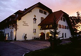 Hotel
Hotel -
 Gasthof
 -
 Railway bridge


See also
- Freilassing, Geschichte einer jungen Stadt; Kurt Enzinger, Rupertus-Verlag 2003, ISBN 3-902317-01-9
References
- Bayerisches Landesamt für Statistik, accessed 19 July 2021.
- ^ Genesis Online-Datenbank des Bayerischen Landesamtes für Statistik Tabelle 12411-003r Fortschreibung des Bevölkerungsstandes: Gemeinden, Stichtag (Einwohnerzahlen auf Grundlage des Zensus 2011) (Hilfe dazu).
External links
- Official website
 (in German)
Towns and municipalities in Berchtesgadener Land | ||
|---|---|---|
 | ||
| International | |
|---|---|
| National | |
| Geographic | |